
IMAGES TAKEN NEAR TO
Haze Croft, WORCESTER, WR4 0EY
Introduction
This page details the photographs taken nearby to Haze Croft, WR4 0EY by members of the Geograph project.
The Geograph project started in 2005 with the aim of publishing, organising and preserving representative images for every square kilometre of Great Britain, Ireland and the Isle of Man.

There are currently over 7.5m images from over14,400 individuals and you can help contribute to the project by visiting https://www.geograph.org.uk
Image Map
Images are licensed for reuse under creativecommons.org/licenses/by-sa/2.0
Notes
- Clicking on the map will re-center to the selected point.
- The higher the marker number, the further away the image location is from the centre of the postcode.
Image Listing (118 Images Found)
Images are licensed for reuse under creativecommons.org/licenses/by-sa/2.0
Image
Details
Distance
1
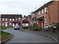
Haze Croft, Lyppard-Hanford
Seen from Wood Leason Avenue that is the main thoroughfare in this part of Warndon Villages.
Image: © Chris Allen
Taken: 16 Jan 2020
0.01 miles
2

Path leading from the end of Haze Croft, Lyppard-Hanford
This path crosses another path at 90 degrees and runs past the end of a play area before leading to Slade Avenue.
Image: © Chris Allen
Taken: 9 Jan 2020
0.01 miles
3
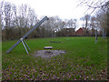
Play area, Lyppard-Hanford
One of several play areas in Warndon Villages.
Image: © Chris Allen
Taken: 9 Jan 2020
0.02 miles
4
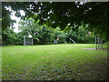
Play area, Lyppard-Hanford, Worcester
One of many green/play areas scattered throughout the large complex that is Wardon Villages. This is the view from the path leading from one end of Great Oaty Gardens.
Image: © Chris Allen
Taken: 15 Jun 2022
0.03 miles
5
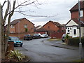
The blind end of Hill Wood Close, Lyppard Hanford
A cul-de-sac in Warndon Villages. I believe I had followed a path from the path passing between different parts of the 'Villages' to appear at the end of this particular street. It took a lot of scrutiny of the aerial view and Streetview to pin this down.
Image: © Chris Allen
Taken: 16 Jan 2020
0.03 miles
6
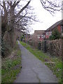
Path in the Lyppards from Mill Wood Drive
This public footpath separates two parts of Lyppard Hanford within the Warndon Villages complex.
Image: © Chris Allen
Taken: 16 Jan 2020
0.03 miles
7
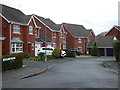
Tavern Orchard, Lyppard-Hanford
From Wood Leason Avenue. This is one of many cul-de-sacs in Warndon villages that tend to lead off sinuous spine roads that are usually also ultimately cul-de-sacs. There is a complex series of footpaths linking and separating the various parts of Warndon Villages.
Image: © Chris Allen
Taken: 16 Jan 2020
0.06 miles
8
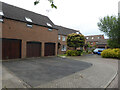
Great Oaty Gardens, Lyppard-Hanford, Worcester
This is one end of this T-shaped cul-de-sac. it is by the path leading into the adjoining green play area.
Image: © Chris Allen
Taken: 15 Jun 2022
0.06 miles
9
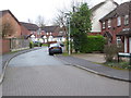
Hillwood Close, Lyppard Hanford
Seen from Wood Leason Avenue.
Image: © Chris Allen
Taken: 16 Jan 2020
0.06 miles
10
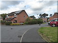
Six Acres Croft, Lyppard-Hanford
Looking into Six Acres Croft on the Lyppard-Hanford housing development. The photographer is on Slade Avenue.
Image: © Chris Allen
Taken: 6 Oct 2019
0.07 miles