
IMAGES TAKEN NEAR TO
Morton Avenue, WORCESTER, WR3 7UE
Introduction
This page details the photographs taken nearby to Morton Avenue, WR3 7UE by members of the Geograph project.
The Geograph project started in 2005 with the aim of publishing, organising and preserving representative images for every square kilometre of Great Britain, Ireland and the Isle of Man.

There are currently over 7.5m images from over14,400 individuals and you can help contribute to the project by visiting https://www.geograph.org.uk
Image Map
Images are licensed for reuse under creativecommons.org/licenses/by-sa/2.0
Notes
- Clicking on the map will re-center to the selected point.
- The higher the marker number, the further away the image location is from the centre of the postcode.
Image Listing (6 Images Found)
Images are licensed for reuse under creativecommons.org/licenses/by-sa/2.0
Image
Details
Distance
1
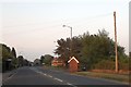
Bus stop and shelter in Fernhill Heath
A brick-built shelter, sensibly orientated to allow passengers to see oncoming buses while waiting inside.
Image: © David Smith
Taken: 19 May 2013
0.07 miles
2
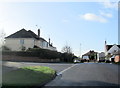
Dilmore Avenue Junction With Dilmore Lane Fernhall Heath
Image: © Roy Hughes
Taken: 16 Jan 2018
0.16 miles
3
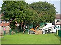
Tree Cutting
The trees are alongside the footpath, just outside the children's playground.
Image: © Mary and Angus Hogg
Taken: 28 Sep 2008
0.22 miles
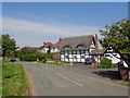
6
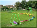
In The Playground
Viewed on a Sunday morning in September, before many children had arrived. The play equipment offers opportunities for all ages.
Image: © Mary and Angus Hogg
Taken: 28 Sep 2008
0.25 miles