IMAGES TAKEN NEAR TO
School Bank, WORCESTER, WR3 7RW
Introduction
This page details the photographs taken nearby to School Bank, WR3 7RW by members of the Geograph project.
The Geograph project started in 2005 with the aim of publishing, organising and preserving representative images for every square kilometre of Great Britain, Ireland and the Isle of Man.

There are currently over 7.5m images from over14,400 individuals and you can help contribute to the project by visiting https://www.geograph.org.uk
Image Map
Images are licensed for reuse under creativecommons.org/licenses/by-sa/2.0
Notes
- Clicking on the map will re-center to the selected point.
- The higher the marker number, the further away the image location is from the centre of the postcode.
Image Listing (63 Images Found)
Images are licensed for reuse under creativecommons.org/licenses/by-sa/2.0
Image
Details
Distance

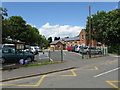
3
Claines C of E Primary School
Victorian school buildings complete with a Worcester "Black Pear" tree.
Image: © Bob Embleton
Taken: 13 Nov 2005
0.08 miles
4

Power lines over Vicarage Lane, Claines
Image: © Jeff Gogarty
Taken: 20 May 2018
0.09 miles
5

A449 just south east of Claines Roundabout
Image: © John Firth
Taken: 23 Dec 2012
0.10 miles
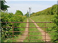
6
Entrance to Daniel's Farm
The entrance to Daniel's Farm near Claines.
Image: © Philip Halling
Taken: 23 May 2012
0.11 miles
7
Transmitter masts next to Claines Primary School
Image: © Jeff Gogarty
Taken: 20 May 2018
0.11 miles

9

Trunk road approach
The A 449 on the approach to Claines roundabout, an unfortunate engineering blemish on this otherwise excellently aligned road. No fewer than three gridsquares are visible in the photograph, though no telephoto was used.
Image: © Peter Whatley
Taken: 19 Jun 2008
0.14 miles
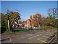
10

Road junction at Claines, Worcs
Claines is an old village immediately to the north of the City of Worcester. The road going from left to right is Claines Lane. The road immediately in the foreground is Cornmeadow Lane. The road branching off Claines Lane to the left is School Bank.
Image: © P L Chadwick
Taken: 31 Dec 2013
0.17 miles