IMAGES TAKEN NEAR TO
Vicarage Lane, WORCESTER, WR3 7RP
Introduction
This page details the photographs taken nearby to Vicarage Lane, WR3 7RP by members of the Geograph project.
The Geograph project started in 2005 with the aim of publishing, organising and preserving representative images for every square kilometre of Great Britain, Ireland and the Isle of Man.

There are currently over 7.5m images from over14,400 individuals and you can help contribute to the project by visiting https://www.geograph.org.uk
Image Map
Images are licensed for reuse under creativecommons.org/licenses/by-sa/2.0
Notes
- Clicking on the map will re-center to the selected point.
- The higher the marker number, the further away the image location is from the centre of the postcode.
Image Listing (7 Images Found)
Images are licensed for reuse under creativecommons.org/licenses/by-sa/2.0
Image
Details
Distance
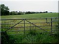
2
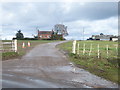
Entrance to Daniel's Farm
The entrance to Daniel's Farm near Claines.
Image: © Philip Halling
Taken: 23 May 2012
0.09 miles
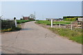
3

Power lines over Vicarage Lane, Claines
Image: © Jeff Gogarty
Taken: 20 May 2018
0.10 miles
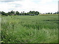

6
Farmland near Fernhill Heath
Looking westwards from Jacob's Ladder Lane.
Image: © Trevor Rickard
Taken: 15 Jul 2007
0.21 miles