
IMAGES TAKEN NEAR TO
Northwick Road, WORCESTER, WR3 7RE
Introduction
This page details the photographs taken nearby to Northwick Road, WR3 7RE by members of the Geograph project.
The Geograph project started in 2005 with the aim of publishing, organising and preserving representative images for every square kilometre of Great Britain, Ireland and the Isle of Man.

There are currently over 7.5m images from over14,400 individuals and you can help contribute to the project by visiting https://www.geograph.org.uk
Image Map
Images are licensed for reuse under creativecommons.org/licenses/by-sa/2.0
Notes
- Clicking on the map will re-center to the selected point.
- The higher the marker number, the further away the image location is from the centre of the postcode.
Image Listing (13 Images Found)
Images are licensed for reuse under creativecommons.org/licenses/by-sa/2.0
Image
Details
Distance
2
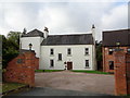
Common Mill House, Northwick Road, Claines
Image: © Jeff Gogarty
Taken: 15 Oct 2017
0.10 miles
4
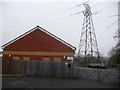
Brethren's Meeting Room and place of worship, Northwick Road
That's what this little modern brick building is. Plymouth Brethren? Or another religious affiliation of believers?
This building was built in 2003 apparently. And the group concerned are known as the Exclusive Brethren - a group not open to the public and the group apparently don't eat or drink with non-brethren, won't own TVs, as 'separation' is part of their dictum or doctrine. Interesting people. Interesting religion.
Do they own cars? Have central heating? Live in homes? Read newspapers? Shop in high street shops? Do they give away their incomes or savings to help the deserving? Intervene internationally in war zones to aid refugees?
Compellingly fascinating and seriously repellent at the same time? I don't know. It takes all sorts to make a world.
Image: © Jeremy Bolwell
Taken: 16 Jan 2013
0.21 miles
5
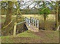
Footbridge over a brook
The path along this bank of the River Severn continues into the next field by means of this bridge, which crosses a narrow brook. Unfortunately the bars across this bridge mean it isn't fully accessible. Hopefully this is something that will be addressed, especially as nearby stiles on this path have been replaced by kissing gates.
Updated November 2012:- The metal bars have been replaced by a gate. See:- Image
Image: © P L Chadwick
Taken: 31 Jan 2010
0.22 miles
6
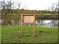
Information board by River Severn
An information board that currently has no information.
Image: © P L Chadwick
Taken: 31 Jan 2010
0.23 miles
8
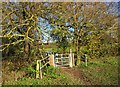
Gate to footbridge over a brook, near Northwick, Worcester
The gate replaces metal bars which made access to the footbridge difficult or impossible for people with restricted mobility. How it used to be:- Image
Image
Image: © P L Chadwick
Taken: 18 Nov 2012
0.23 miles
9

Footbridge over a brook, near Northwick, Worcester
A public footpath runs along the east bank of the River Severn in the Northwick area. This footbridge takes it across a brook, which is many feet below. On the far side of the footbridge, the footpath crosses another field, keeping near the bank of the river.
Image
Image: © P L Chadwick
Taken: 18 Nov 2012
0.23 miles
10
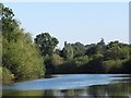
Bend on the River Severn, south-east of Green Park
Seen from a narrowboat heading upstream.
Image: © Christine Johnstone
Taken: 7 Sep 2012
0.23 miles