
IMAGES TAKEN NEAR TO
Wilks Close, WORCESTER, WR2 5NL
Introduction
This page details the photographs taken nearby to Wilks Close, WR2 5NL by members of the Geograph project.
The Geograph project started in 2005 with the aim of publishing, organising and preserving representative images for every square kilometre of Great Britain, Ireland and the Isle of Man.

There are currently over 7.5m images from over14,400 individuals and you can help contribute to the project by visiting https://www.geograph.org.uk
Image Map
Images are licensed for reuse under creativecommons.org/licenses/by-sa/2.0
Notes
- Clicking on the map will re-center to the selected point.
- The higher the marker number, the further away the image location is from the centre of the postcode.
Image Listing (88 Images Found)
Images are licensed for reuse under creativecommons.org/licenses/by-sa/2.0
Image
Details
Distance
1
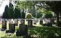
Cemetery, St Johns, Worcester
Looking towards the railway line to Malvern.
Image: © Bob Embleton
Taken: 12 Aug 2007
0.10 miles
2
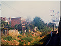
Signals approaching Worcester
Even in the 1980s, "lower-quadrant" signals such as these (i.e. ones that drop below the horizontal to indicate 'line clear') were rare.
Image: © Stephen Craven
Taken: 11 Sep 1985
0.11 miles
3

Cemetery, Worcester
A burial ground tucked away off the Bromyard Road with a view to allotments and housing.
Image: © Chris Allen
Taken: 29 Sep 2012
0.11 miles
5
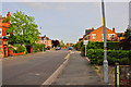
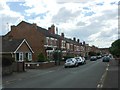
Worcester : Laugherne Road
Looking along Laugherne Road in the residential areas of Worcester.
Image: © Lewis Clarke
Taken: 3 May 2014
0.13 miles
6

Public footpath adjacent to cemetery, St. John's, Worcester
The cemetery is behind the railings on the left. In the distance is the junction with Meco Alley and a footpath to Sanctuary Close.
Image
Image: © P L Chadwick
Taken: 2 Jun 2018
0.15 miles
7
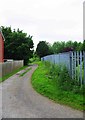
Public footpath adjacent to cemetery, St. John's, Worcester
The cemetery is behind the railings on the right. The path provides a link to residential roads.
Image
Image: © P L Chadwick
Taken: 2 Jun 2018
0.15 miles
8
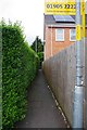
Footpath off Lambert Road, St. John's, Worcester
This hard surfaced footpath starts at this end at the corner of Lambert Road and Happy Land West. It then makes a left turn and runs parallel to the Hereford to Worcester railway line before joining a path which connects Bromyard Road with Sanctuary Close and other paths.
Image: © P L Chadwick
Taken: 2 Jun 2018
0.15 miles
9
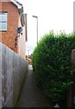
Footpath to Lambert Road, St. John's, Worcester
This hard-surfaced footpath leads to the junction of Lambert Road and Happy Land West.
Image
Image: © P L Chadwick
Taken: 2 Jun 2018
0.15 miles
10
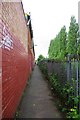
Footpath running parallel to railway line, St. John's, Worcester
The Hereford to Worcester railway line is behind the railings and trees on the right.
Image: © P L Chadwick
Taken: 2 Jun 2018
0.15 miles