
IMAGES TAKEN NEAR TO
Rosemary Avenue, WORCESTER, WR2 5HE
Introduction
This page details the photographs taken nearby to Rosemary Avenue, WR2 5HE by members of the Geograph project.
The Geograph project started in 2005 with the aim of publishing, organising and preserving representative images for every square kilometre of Great Britain, Ireland and the Isle of Man.

There are currently over 7.5m images from over14,400 individuals and you can help contribute to the project by visiting https://www.geograph.org.uk
Image Map
Images are licensed for reuse under creativecommons.org/licenses/by-sa/2.0
Notes
- Clicking on the map will re-center to the selected point.
- The higher the marker number, the further away the image location is from the centre of the postcode.
Image Listing (89 Images Found)
Images are licensed for reuse under creativecommons.org/licenses/by-sa/2.0
Image
Details
Distance
1
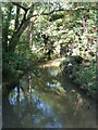
The Laugherne Brook
Seen from a bridge on a public footpath from the A44 to Dines Green.
Image: © Chris Allen
Taken: 29 Sep 2012
0.11 miles
2
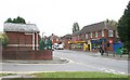
Shops in Broadway Grove
With the Premier newsagents and general store, next door Pete's Plaice and over the road the small building is the sewage pumping station!
Image: © Bob Embleton
Taken: 23 Sep 2007
0.11 miles
4
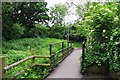
Footbridge over Laughern Brook, St. John's, Worcester
Looking in the direction of the centre of St. John's (which is a long walk from here).
Image
Image: © P L Chadwick
Taken: 2 Jun 2018
0.12 miles
5
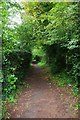
Public footpath on north side of pedestrian level crossing, St. John's, Worcester
The path later joins others serving various housing estates and a cemetery.
Image: © P L Chadwick
Taken: 2 Jun 2018
0.12 miles
6
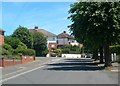
Broadway Grove, Worcester
A residential area on the outskirts of the city, near Rushwick.
Image: © Mary and Angus Hogg
Taken: 9 Jun 2008
0.12 miles
7
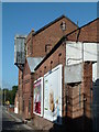
The Ice works, Worcester
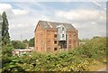
Alongside the A44 Bromyard Road is this imposing building that started life as a watermill but then became an ice works and cold store. According to the faded brass plaques alongside the door it was home to cold storage and dry ice companies.
Image: © Chris Allen
Taken: 29 Sep 2012
0.12 miles
8
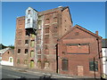
The Ice Works, Bromyard Road, worcester.
Alongside the A44 Bromyard Road is this imposing building that started life as a watermill but then became an ice works and cold store. According to the faded brass plaques alongside the door it was home to cold storage and dry ice companies.
Image: © Chris Allen
Taken: 29 Sep 2012
0.12 miles
9
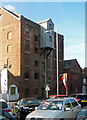
Mudwall Mill, Bromyard Road, Worcester
Aka St John's Mill. Originally water-powered, then steam-powered. Built 1869 and altered in the 1890s. The hoist canopy survives.
Looking disused at the time but buildings behind were in various light industrial uses.
Image: © Stephen Richards
Taken: 17 Jul 2014
0.12 miles
10
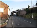
Into the city
View along the A44 Bromyard road towards Worcester with the rail bridge in mid-photo.
Image: © Bill Nicholls
Taken: 17 Jan 2011
0.12 miles