IMAGES TAKEN NEAR TO
Shaw Walk, MALVERN, WR14 2YE
Introduction
This page details the photographs taken nearby to Shaw Walk, WR14 2YE by members of the Geograph project.
The Geograph project started in 2005 with the aim of publishing, organising and preserving representative images for every square kilometre of Great Britain, Ireland and the Isle of Man.

There are currently over 7.5m images from over14,400 individuals and you can help contribute to the project by visiting https://www.geograph.org.uk
Image Map (Loading...)


Getting Data...Please wait
Leaflet Map data © OpenStreetMap
Images are licensed for reuse under creativecommons.org/licenses/by-sa/2.0
Notes
- Clicking on the map will re-center to the selected point.
- The higher the marker number, the further away the image location is from the centre of the postcode.
Image Listing (8 Images Found)
Images are licensed for reuse under creativecommons.org/licenses/by-sa/2.0
Image
Details
Distance
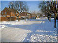
1
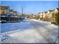
Charles Way
View north with the entrance to North End Lane on the left.
Image: © Trevor Rickard
Taken: 8 Jan 2010
0.09 miles
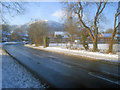
2
North End Lane
Looking north-east along the B4208 main thoroughfare around the west side of Malvern Link.
Image: © Trevor Rickard
Taken: 8 Jan 2010
0.10 miles
3
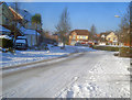
May Bank
View north-west along the entrance road to several other roads on this large 1990s estate.
Image: © Trevor Rickard
Taken: 8 Jan 2010
0.11 miles
4
North End Lane
View west to North Hill. Barnards Green Cricket Club on the right.
Image: © Trevor Rickard
Taken: 8 Jan 2010
0.13 miles
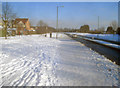
5
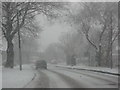
And down came the snow...
Unpleasant driving conditions on North End Road in Malvern (I was in the passenger seat).
Image: © Philip Halling
Taken: 20 Dec 2010
0.16 miles
6
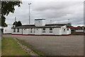
Malvern Town Football Club
The outside of the pavilion.
Image: © Bob Embleton
Taken: 8 Sep 2011
0.23 miles
7
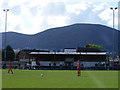
Langland Stadium
The picturesque home of Malvern Town FC.
Image: © Stuart Shepherd
Taken: 25 Apr 2009
0.24 miles
8
Bawdsey Avenue
Running east from Pickersleigh Road.
Image: © Trevor Rickard
Taken: 8 Jan 2010
0.24 miles