
IMAGES TAKEN NEAR TO
Reynolds Close, MALVERN, WR13 6SJ
Introduction
This page details the photographs taken nearby to Reynolds Close, WR13 6SJ by members of the Geograph project.
The Geograph project started in 2005 with the aim of publishing, organising and preserving representative images for every square kilometre of Great Britain, Ireland and the Isle of Man.

There are currently over 7.5m images from over14,400 individuals and you can help contribute to the project by visiting https://www.geograph.org.uk
Image Map
Images are licensed for reuse under creativecommons.org/licenses/by-sa/2.0
Notes
- Clicking on the map will re-center to the selected point.
- The higher the marker number, the further away the image location is from the centre of the postcode.
Image Listing (37 Images Found)
Images are licensed for reuse under creativecommons.org/licenses/by-sa/2.0
Image
Details
Distance
1
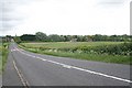
Marlbank Farm, Welland
Taken from the A4104 Marlbank Hill looking down the road into Welland Village and the 30mph signs that are so often ignored. The farmhouse to the right of centre is Marlbank Farm.
Image: © Bob Embleton
Taken: 8 May 2007
0.05 miles
2
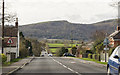
A4101 Marlbank Road
Towards the Malvern Hills.
Image: © J.Hannan-Briggs
Taken: 24 Feb 2017
0.05 miles
3
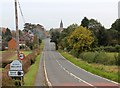
The Marlbank Road into Welland
The A4104 from Little Malvern to Pershore.
The red colour on the road shows where the 30 mph speed limit used to be - just over the brow of the Marlbank hill.
Now there is a 40 mph speed limit well before the dip and the 30 mph has been moved closer to the residential properties.
Image: © Bob Embleton
Taken: 19 Oct 2012
0.06 miles
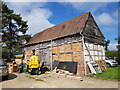
5
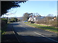
Marlbank Road
Looking westwards along the A4104 with the Malvern Hills in the background.
Image: © Trevor Rickard
Taken: 6 Feb 2008
0.07 miles
6
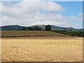
Malvern Hills from outside Marlbank Farm (1)
Image: © Jeff Gogarty
Taken: 28 Aug 2021
0.07 miles
7
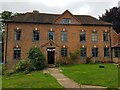
Marlbank Farmhouse, Welland
Taken on Worcestershire Open Weekend with the permission of the owners.
House. Circa 1700. Brick with hipped tile roof.
Image: © Jeff Gogarty
Taken: 28 Aug 2021
0.07 miles
8
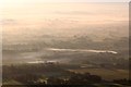
Smoke over the Marlbank Brook
The smoke from a small fire at Welland Farm fails to rise and subsequently spreads northwards following the low land of the brook between the high ground of the Marlbank and St James' church in Welland.
Most of the council house estate on the left of the A road and the more modern Bishop's Wood housing estate to the right is covered by the thin drifts of white smoke.
Taken from the top of Black Hill on the Malverns where the chilly breeze was blowing from the north - the opposite direction to the smoke on the lowlands below.
Image: © Bob Embleton
Taken: 22 Sep 2012
0.09 miles
9
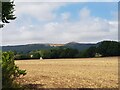
Malvern Hills from outside Marlbank Farm (2)
Image: © Jeff Gogarty
Taken: 28 Aug 2021
0.09 miles
10
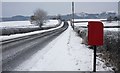
The Marlbank Road
Taken from opposite the track to Marlbank Farm.
Image: © Bob Embleton
Taken: 20 Dec 2010
0.09 miles