
IMAGES TAKEN NEAR TO
Walwyn Road, MALVERN, WR13 6EG
Introduction
This page details the photographs taken nearby to Walwyn Road, WR13 6EG by members of the Geograph project.
The Geograph project started in 2005 with the aim of publishing, organising and preserving representative images for every square kilometre of Great Britain, Ireland and the Isle of Man.

There are currently over 7.5m images from over14,400 individuals and you can help contribute to the project by visiting https://www.geograph.org.uk
Image Map
Images are licensed for reuse under creativecommons.org/licenses/by-sa/2.0
Notes
- Clicking on the map will re-center to the selected point.
- The higher the marker number, the further away the image location is from the centre of the postcode.
Image Listing (60 Images Found)
Images are licensed for reuse under creativecommons.org/licenses/by-sa/2.0
Image
Details
Distance
2
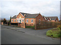
Colwall Village Hall
The building appears to straddle four gridsquares.
The semi-circular date stone above the door reads:
1927 Colway Church Room.
Image: © Pauline E
Taken: 21 Nov 2008
0.06 miles
3
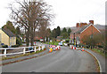
Heading for Colwall Stone
The 'temporary' traffic lights and height restrictor are in place until the replacement bridge over the railway is in place - scheduled for March 2009.
Image: © Pauline E
Taken: 21 Nov 2008
0.06 miles
4
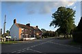
Railway Terrace, Colwall Green
The road junction is formed by the lane from Colwall church meeting the B4218 Malvern-Ledbury road. The railway line runs a little way behind the terrace of 4 houses and on the right are the traffic lights controlling traffic across the weak bridge across the line - see Image
Image: © Derek Harper
Taken: 13 Sep 2008
0.06 miles
5
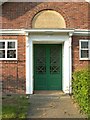
St Crispin's Chapel - Colwall
St Crispin's Chapel is joined to the more recent Colwall Village Hall. The inscription above the door reads "1927 Church Room"
Image: © Liz Hill
Taken: 25 Jun 2020
0.06 miles
6
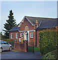
Colwall Village Hall
Just in SO7542 by a few metres, the hall is at the south end of the village near the school.
Image: © Des Blenkinsopp
Taken: 2 Nov 2022
0.06 miles
8
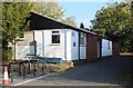
Scout Hut, Colwall
For the 1st Colwall Scout Group.
Just to the north of the Village Hall.
Image: © Bob Embleton
Taken: 15 Oct 2011
0.07 miles
9
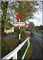
Old & New Red Triangles
The red triangle has been the standard warning symbol on traffic signs for a long time. The two signs here are separated by many decades.
I found this on the web "The 1934 national British signs included: a red disc (for a prohibition), a red open triangle (for a warning or hazard), a red ring (for an order), and a red open triangle in a circle for a new warning with an order (which had the plates 'SLOW - MAJOR ROAD AHEAD' and 'HALT AT MAJOR ROAD AHEAD', the predecessors of 'GIVE WAY' and 'STOP' signs respectively)."
It doesn't say when red triangles were first used, but they've been about for a long time.
Image: © Des Blenkinsopp
Taken: 2 Nov 2022
0.07 miles
10
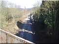
Railway line at Colwall
View north-east from the bridge along the line just south of the station.
Image: © Trevor Rickard
Taken: 4 Mar 2008
0.08 miles