
IMAGES TAKEN NEAR TO
Westbourne, EVESHAM, WR11 7PT
Introduction
This page details the photographs taken nearby to Westbourne, WR11 7PT by members of the Geograph project.
The Geograph project started in 2005 with the aim of publishing, organising and preserving representative images for every square kilometre of Great Britain, Ireland and the Isle of Man.

There are currently over 7.5m images from over14,400 individuals and you can help contribute to the project by visiting https://www.geograph.org.uk
Image Map
Images are licensed for reuse under creativecommons.org/licenses/by-sa/2.0
Notes
- Clicking on the map will re-center to the selected point.
- The higher the marker number, the further away the image location is from the centre of the postcode.
Image Listing (73 Images Found)
Images are licensed for reuse under creativecommons.org/licenses/by-sa/2.0
Image
Details
Distance
1
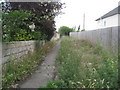
Footpath between the houses at Honeybourne
Image: © Jonathan Thacker
Taken: 28 Jun 2011
0.09 miles
2
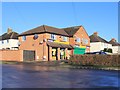
Honeybourne Stores
Convenience shop in Grove Avenue.
Image: © David P Howard
Taken: 17 Dec 2011
0.10 miles
4
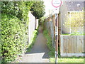
Path leaves road
The path leaves Station Road and runs to Westbourne and Grove Avenue.
Image: © Michael Dibb
Taken: 21 Apr 2012
0.11 miles
5
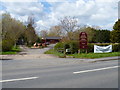
Domestic Fowl Trust
Located in Station Road, Honeybourne, the trust is a supplier of poultry and poultry equipment and housing. There is a farm park where the public can see and learn about a variety of animals with the chance to meet them. For more details see their web site http://www.domesticfowltrust.co.uk/index.html
Image: © Michael Dibb
Taken: 21 Apr 2012
0.12 miles
6
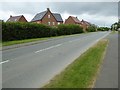
The route of an old Roman Road in Honeybourne
This straight road in Honeybourne follows the route of Ryknild Street, a former Roman Road. The houses behind the hedge are a recent development, built on what was the site of annual sheep sales Image
Image: © Philip Halling
Taken: 16 Jul 2016
0.12 miles
7
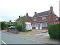
Houses on the Stratford Rd
These detached houses are on the northern edge of this village on the road to Pebworth, Long Marston and Stratford.
Image: © Nigel Mykura
Taken: 22 Jun 2013
0.13 miles
8
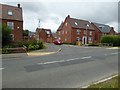
New houses in Honeybourne
These houses have been built recently on a site which used to be the site of annual sheep sales Image The roads are named after sheep breeds such as Herdwick and Clun.
Image: © Philip Halling
Taken: 16 Jul 2016
0.13 miles
9
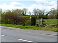
Path meets road
The footpath from High Street meets Station Road. The path continues on the opposite side of the road.
Image: © Michael Dibb
Taken: 21 Apr 2012
0.13 miles
10
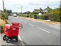
Stratford Road, Honeybourne
Featuring a postman's trolley.
Image: © Des Blenkinsopp
Taken: 24 Jul 2018
0.14 miles