IMAGES TAKEN NEAR TO
Greenhill Park Road, EVESHAM, WR11 4NL
Introduction
This page details the photographs taken nearby to Greenhill Park Road, WR11 4NL by members of the Geograph project.
The Geograph project started in 2005 with the aim of publishing, organising and preserving representative images for every square kilometre of Great Britain, Ireland and the Isle of Man.

There are currently over 7.5m images from over14,400 individuals and you can help contribute to the project by visiting https://www.geograph.org.uk
Image Map (Loading...)


Getting Data...Please wait
Leaflet Map data © OpenStreetMap
Images are licensed for reuse under creativecommons.org/licenses/by-sa/2.0
Notes
- Clicking on the map will re-center to the selected point.
- The higher the marker number, the further away the image location is from the centre of the postcode.
Image Listing (11 Images Found)
Images are licensed for reuse under creativecommons.org/licenses/by-sa/2.0
Image
Details
Distance
1
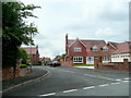
Prince Henry's Close, Evesham
A newly-developed cul-de-sac off Greenhill Park Road.
Image: © Jonathan Billinger
Taken: 7 Jun 2010
0.05 miles
2
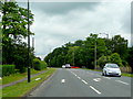
A4184 at Greenhill, Evesham
The old A435 looking north towards Bidford and Alcester.
Image: © Jonathan Billinger
Taken: 7 Jun 2010
0.06 miles
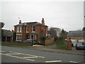
3
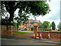
The Gables
A substantial red-brick property on Greenhill Park Road, Evesham.
Image: © Jonathan Billinger
Taken: 7 Jun 2010
0.06 miles
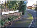
4
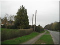
The old and the not so new
A rather large telegraph pole and a possible Victorian or Edwardian sewage stench pipe. Most of the period housing however is on the other side of the road.
Image: © Anthony Vosper
Taken: 10 Mar 2017
0.10 miles
5
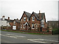
Fernbank House
A double gabled late Victorian house.
There are crosses marked by bricks in the gables.
There may well have been a religious connection at some point in time.
Image: © Anthony Vosper
Taken: 10 Mar 2017
0.10 miles
6
Between the houses, Greenhill
Narrow footpath between Greenhill and the old orchards, overlooking the River Avon, Evesham.
Image: © Liz Stone
Taken: 27 Jan 2013
0.12 miles
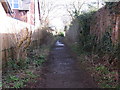
7
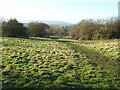
Footpath to the orchards
The hill gives an amazing view over the river Avon.
Image: © Anthony Vosper
Taken: 10 Mar 2017
0.13 miles
8
Simon De Montfort Drive
This road in the Greenhill area of Evesham is named after Simon De Montfort who was killed at the nearby battlefield in 1265.
Image: © Philip Halling
Taken: 17 Jan 2022
0.14 miles
10
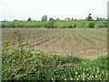
Battle of Evesham site
This path provides access to the site of the Battle of Evesham which took place on 4 August 1265 resulting with Simon De Montfort being defeated and killed.
Image: © Philip Halling
Taken: 17 Jan 2022
0.24 miles