
IMAGES TAKEN NEAR TO
Netherton Lane, PERSHORE, WR10 3JF
Introduction
This page details the photographs taken nearby to Netherton Lane, WR10 3JF by members of the Geograph project.
The Geograph project started in 2005 with the aim of publishing, organising and preserving representative images for every square kilometre of Great Britain, Ireland and the Isle of Man.

There are currently over 7.5m images from over14,400 individuals and you can help contribute to the project by visiting https://www.geograph.org.uk
Image Map
Images are licensed for reuse under creativecommons.org/licenses/by-sa/2.0
Notes
- Clicking on the map will re-center to the selected point.
- The higher the marker number, the further away the image location is from the centre of the postcode.
Image Listing (93 Images Found)
Images are licensed for reuse under creativecommons.org/licenses/by-sa/2.0
Image
Details
Distance
2
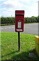
Elizabeth II postbox on Cornmill Close, Elmley Castle
Postbox No. WR10 499.
Image: © JThomas
Taken: 12 Aug 2021
0.03 miles
3
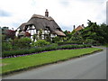
Thatched cottage in Elmley Castle
Thatched cottage on Netherton Lane in Elmley Castle.
Image: © Philip Halling
Taken: 15 Jun 2008
0.06 miles
4
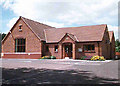
Elmley Castle Village Hall
This was the millennium project for the village.
Image: © Robin Phillips
Taken: 3 Jul 2005
0.07 miles
5
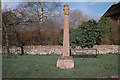
Village Cross
The cross certainly dates from the 17th century, but it is most probably much older.
Image: © Robin Phillips
Taken: Unknown
0.07 miles
6
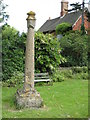
Cross in Elmley Castle
Cross standing on the junction with Netherton lane.
Image: © Philip Halling
Taken: 15 Jun 2008
0.08 miles
7
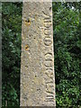
Figures engraved in the cross, Elmley Castle
Image: © Philip Halling
Taken: 15 Jun 2008
0.08 miles
9
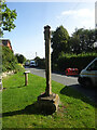
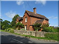
Village Cross, Elmley Castle
A medieval "Central Cross" at the junction of Netherton Lane and Main Street.
Grade II list monument Nᴼ 1116596 see https://historicengland.org.uk/listing/the-list/list-entry/1116596
Milestone Society National ID: WOWA_ELM
Image: © Mr Red
Taken: 26 Sep 2023
0.09 miles
10
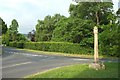
Cross, Elmley Castle
The cross is also shown at http://www.geograph.org.uk/search.php?i=73248835 . A very detailed description is at https://www.historicengland.org.uk/listing/the-list/list-entry/1015287 : "Both socket stone and shaft are probably of 14th century date ... The south face of the shaft is engraved down the east side with rounded Roman numerals, which were probably added in the 17th century when the existing head was added to the shaft".
The road junction is at the north end of the main village street (ahead left). The other two roads are used by NCN442.
Image: © Derek Harper
Taken: 1 Jul 2017
0.10 miles