Village Cross, Elmley Castle
Introduction
The photograph on this page of Village Cross, Elmley Castle by Mr Red as part of the Geograph project.
The Geograph project started in 2005 with the aim of publishing, organising and preserving representative images for every square kilometre of Great Britain, Ireland and the Isle of Man.

There are currently over 7.5m images from over 14,400 individuals and you can help contribute to the project by visiting https://www.geograph.org.uk
Village Cross, Elmley Castle
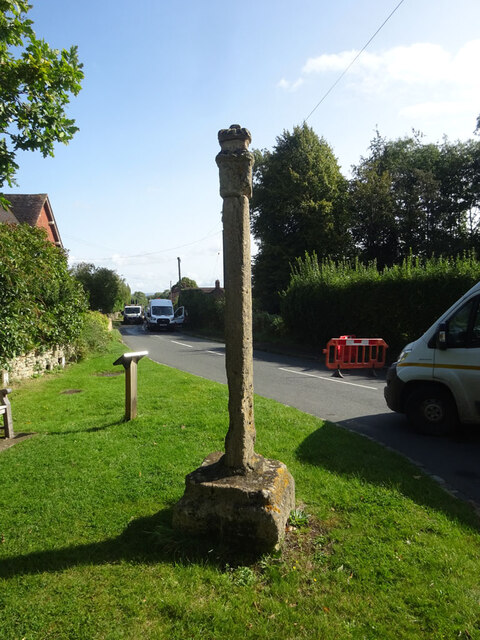
Image: © Mr Red Taken: 26 Sep 2023
A medieval "Central Cross" at the junction of Netherton Lane and Main Street. Grade II list monument Nᴼ 1116596 see https://historicengland.org.uk/listing/the-list/list-entry/1116596 Milestone Society National ID: WOWA_ELM
Images are licensed for reuse under creativecommons.org/licenses/by-sa/2.0
Image Location


Leaflet Map data © OpenStreetMap
Latitude
52.071055
Longitude
-2.025938