IMAGES TAKEN NEAR TO
Mount Pleasant, PERSHORE, WR10 1NF
Introduction
This page details the photographs taken nearby to Mount Pleasant, WR10 1NF by members of the Geograph project.
The Geograph project started in 2005 with the aim of publishing, organising and preserving representative images for every square kilometre of Great Britain, Ireland and the Isle of Man.

There are currently over 7.5m images from over14,400 individuals and you can help contribute to the project by visiting https://www.geograph.org.uk
Image Map (Loading...)


Getting Data...Please wait
Leaflet Map data © OpenStreetMap
Images are licensed for reuse under creativecommons.org/licenses/by-sa/2.0
Notes
- Clicking on the map will re-center to the selected point.
- The higher the marker number, the further away the image location is from the centre of the postcode.
Image Listing (44 Images Found)
Images are licensed for reuse under creativecommons.org/licenses/by-sa/2.0
Image
Details
Distance
1
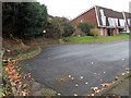
Turning area at the southern end of Acorn Grove, Pershore
A Worcestershire County Council notice shows Turning area. No parking.
Image: © Jaggery
Taken: 16 Nov 2014
0.02 miles
2
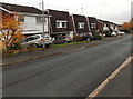
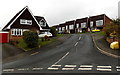
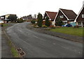
East side of Acorn Grove, Pershore
Looking south from the Ashdale Avenue end.
Image: © Jaggery
Taken: 16 Nov 2014
0.03 miles
3
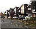
Maple Avenue, Pershore
Cul-de-sac on the NW side of Station Road.
Image: © Jaggery
Taken: 16 Nov 2014
0.04 miles
4
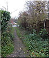
Path from Acorn Grove to Maple Avenue, Pershore
Looking towards Maple Avenue from the edge of the Acorn Grove turning area. http://www.geograph.org.uk/photo/4252955
Image: © Jaggery
Taken: 16 Nov 2014
0.04 miles
5
Acorn Grove, Pershore
Viewed from Ashdale Avenue.
Image: © Jaggery
Taken: 16 Nov 2014
0.05 miles
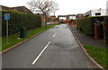
6
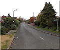
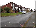
Birchtree Grove, Pershore
Short cul-de-sac on the south side of Ashdale Avenue.
Image: © Jaggery
Taken: 16 Nov 2014
0.07 miles
7
Gig Bridge Lane, Pershore
On the NW side of Station Road, Gig Bridge Lane leads to Mount Pleasant and Mount Pleasant Barns.
Image: © Jaggery
Taken: 16 Nov 2014
0.07 miles
8
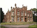
Pershore Hall
A Victorian mansion with an outlook south and east over the Avon Valley across modern housing estates. Now converted to flats.
Image: © Dave Bushell
Taken: 31 Aug 2005
0.07 miles
9
Ashdale Avenue, Pershore
From the corner of Station Road.
Image: © Jaggery
Taken: 16 Nov 2014
0.09 miles
10
Acorn Grove from the south, Pershore
Looking north from this turning area. http://www.geograph.org.uk/photo/4252955
Image: © Jaggery
Taken: 16 Nov 2014
0.09 miles