IMAGES TAKEN NEAR TO
Cherry Orchard, PERSHORE, WR10 1EZ
Introduction
This page details the photographs taken nearby to Cherry Orchard, WR10 1EZ by members of the Geograph project.
The Geograph project started in 2005 with the aim of publishing, organising and preserving representative images for every square kilometre of Great Britain, Ireland and the Isle of Man.

There are currently over 7.5m images from over14,400 individuals and you can help contribute to the project by visiting https://www.geograph.org.uk
Image Map
Images are licensed for reuse under creativecommons.org/licenses/by-sa/2.0
Notes
- Clicking on the map will re-center to the selected point.
- The higher the marker number, the further away the image location is from the centre of the postcode.
Image Listing (60 Images Found)
Images are licensed for reuse under creativecommons.org/licenses/by-sa/2.0
Image
Details
Distance
1
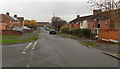
Mayfield Road, Pershore
Viewed from the Station Road end looking along Mayfield Road towards Avon Road.
Image: © Jaggery
Taken: 16 Nov 2014
0.03 miles
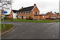
2
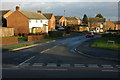
Hurst Road, Pershore
In the 1960s housing was built beside the Station Road to the north of Pershore's town centre.
Image: © Philip Halling
Taken: 23 Nov 2008
0.06 miles
3
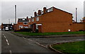
Apple Tree Road, Pershore
On the east side of Station Road.
Image: © Jaggery
Taken: 16 Nov 2014
0.08 miles
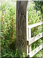
6
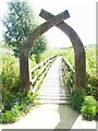
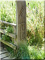
Carved arch entry to Avon Meadows
Avon Meadows Community Wetland and Local Nature Reserve cover 24 hectares of floodplain grassland and is on the edge of Pershore. It is jointly owned by Wychavon and Pershore Town Council and maintained by the Worcestershire Wildlife Trust.
Image: © Jeff Gogarty
Taken: 10 Aug 2021
0.09 miles
7
Corner of Station Road and Mayfield Road, Pershore
Pointing right,the blue cycle route and footpath sign shows three-quarters of a mile to the town centre.
Image: © Jaggery
Taken: 16 Nov 2014
0.10 miles
8
Pershore Care Centre
Worcestershire County Council's Pershore Short Term Breaks Service care home at 48 Station Road.
Image: © Jaggery
Taken: 16 Nov 2014
0.10 miles
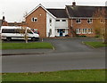
9
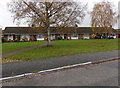
Row of bungalows, Pershore
Located between Station Road and Hurst Road. Originally, bungalow was used in English for a lightly-built house, with a veranda and one storey. In current UK usage it is a convenient word for any one-storey dwelling.
Image: © Jaggery
Taken: 16 Nov 2014
0.11 miles
10
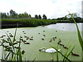
Swan and ducks, Pershore Community Wetlands
Image: © Jeff Gogarty
Taken: 10 Aug 2021
0.12 miles