IMAGES TAKEN NEAR TO
Hand Lane, LEIGH, WN7 3RX
Introduction
This page details the photographs taken nearby to Hand Lane, WN7 3RX by members of the Geograph project.
The Geograph project started in 2005 with the aim of publishing, organising and preserving representative images for every square kilometre of Great Britain, Ireland and the Isle of Man.

There are currently over 7.5m images from over14,400 individuals and you can help contribute to the project by visiting https://www.geograph.org.uk
Image Map (Loading...)


Getting Data...Please wait
Leaflet Map data © OpenStreetMap
Images are licensed for reuse under creativecommons.org/licenses/by-sa/2.0
Notes
- Clicking on the map will re-center to the selected point.
- The higher the marker number, the further away the image location is from the centre of the postcode.
Image Listing (14 Images Found)
Images are licensed for reuse under creativecommons.org/licenses/by-sa/2.0
Image
Details
Distance
1
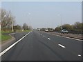
Lay-by on the East Lancashire Road
One of the many such lay-bys on the A580, at least some of which were originally provided with watering points for steam road motors! See: http://www.lancashire.gov.uk/environment/historichighways/eastlancs/index.asp for more details on this epochal highway.
Image: © Peter Whatley
Taken: 24 Mar 2011
0.02 miles
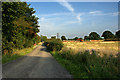
3
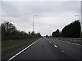
East Lancashire Road
The view eastwards along the East Lancashire Road (A580) to the south of Leigh. Apart from this road the bulk of this square is pasture land. SJ65479773
Image: © Keith Williamson
Taken: 19 Sep 2005
0.04 miles
4
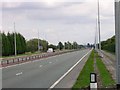
Entrance to Wood's Farm
The access road to Wood's Farm from the A580, East Lancashire Road.
Image: © David Dixon
Taken: 18 Feb 2012
0.05 miles
6
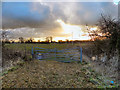
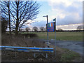
Rugby Pitch
The rugby pitch behind Carr Lane.
Image: © David Dixon
Taken: 18 Feb 2012
0.14 miles
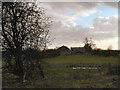
9
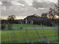
Wood's Farm
A farm to the south of the A580 (East Lancashire Road).
Image: © David Dixon
Taken: 18 Feb 2012
0.17 miles
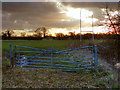
10
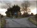
Hand Lane-Carr Lane Junction
The sign indicates that both branches of the fork lead to dead ends.
Image: © David Dixon
Taken: 18 Feb 2012
0.17 miles