1
Ince Plaice, Ince
Fish & chips shop at 132 Warrington Road on the corner of Knowles Street.
Image: © Jaggery
Taken: 23 Sep 2017
0.00 miles
2
PW Fire Protection Ltd office, Warrington Road, Ince
On the northwest side of the single-storey building. Ince Plaice http://www.geograph.org.uk/photo/5549514 occupies the southeast side.
Image: © Jaggery
Taken: 23 Sep 2017
0.01 miles
3
Row of four houses, Warrington Road, Ince
The house on the right is on the corner of Manley Street.
Image: © Jaggery
Taken: 23 Sep 2017
0.01 miles
4
Corner of Warrington Road and Manley Street, Ince
The car is parked in Manley Street.
Image: © Jaggery
Taken: 23 Sep 2017
0.01 miles
5
Top deck, route 658-04
Manley Street goes off to the left. The White Swan is on the right.
Image: © David Long
Taken: 8 Jul 2008
0.01 miles
6
Toronto Pizza, 134 Warrington Road, Ince
Fast food takeaway on the corner of Knowles Street. Rock 'n' Roll Hair salon is on the left.
Image: © Jaggery
Taken: 23 Sep 2017
0.01 miles
7
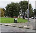
Telecoms cabinet on an Ince corner
The BT cabinet is on the corner of Warrington Road and Manley Street in Ince-in-Makerfield.
Image: © Jaggery
Taken: 23 Sep 2017
0.01 miles
8
Fenced-off area, Warrington Road, Ince
Viewed across the A573 Warrington Road in late September 2017.
The house is part of this row http://www.geograph.org.uk/photo/5549471 near Manley Street.
Image: © Jaggery
Taken: 23 Sep 2017
0.02 miles
9
Former White Swan pub at 136 Warrington Road, Lower Ince
Viewed in September 2017. The White Swan name sign seen here http://www.geograph.org.uk/photo/79507 in 2005 has gone.
Image: © Jaggery
Taken: 23 Sep 2017
0.02 miles
10
Changes
The 'Butty Box' was in the end shop as a sandwich bar. It now has tables and chairs and is a small cafe. The premises had been extensively renovated before the move - and its former premises is now receiving similar treatment.
Image: © David Long
Taken: 7 Sep 2008
0.03 miles


