IMAGES TAKEN NEAR TO
Walthew Lane, WIGAN, WN2 5AE
Introduction
This page details the photographs taken nearby to Walthew Lane, WN2 5AE by members of the Geograph project.
The Geograph project started in 2005 with the aim of publishing, organising and preserving representative images for every square kilometre of Great Britain, Ireland and the Isle of Man.

There are currently over 7.5m images from over14,400 individuals and you can help contribute to the project by visiting https://www.geograph.org.uk
Image Map
Images are licensed for reuse under creativecommons.org/licenses/by-sa/2.0
Notes
- Clicking on the map will re-center to the selected point.
- The higher the marker number, the further away the image location is from the centre of the postcode.
Image Listing (41 Images Found)
Images are licensed for reuse under creativecommons.org/licenses/by-sa/2.0
Image
Details
Distance
1
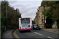
Tight fit
The abutments of the bridge over Warrington Road (A573), which once carried the Wigan-Atherton-Manchester line, which had a spur off to Bickershaw Colliery. It rather resembles an ancient gateway into a mediaeval town.
Image: © David Long
Taken: 9 Oct 2008
0.10 miles
2
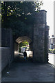
Safe passage
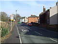
The pedestrian walkway beside the narrow road through the old railway bridge.
Image: © David Long
Taken: 9 Oct 2008
0.10 miles
5
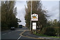
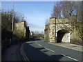
Brand new Geograph-03
The newly-erected sign on the boundary of Spring View, Ince-in-Makerfield.
Image: © David Long
Taken: 9 Oct 2008
0.14 miles
7
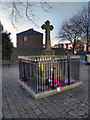
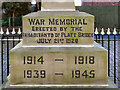
Platt Bridge War Memorial
The war memorial at the junction of Neville Street and Davies Street was erected in 1920. It's a rather sad reflection on modern attitudes that there is a need to protect it with metal railings which make it hard to see unless you go right up to it.
Image: © David Dixon
Taken: 23 Feb 2012
0.16 miles
9
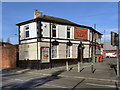
The Queens Arms, Platt Bridge
The Queens Arms public house at the junction of Walthew Lane (A573) and Liverpool Road (A58) in Platt Bridge.
Image: © David Dixon
Taken: 23 Feb 2012
0.17 miles