
IMAGES TAKEN NEAR TO
Romford Place, WIGAN, WN2 3LP
Introduction
This page details the photographs taken nearby to Romford Place, WN2 3LP by members of the Geograph project.
The Geograph project started in 2005 with the aim of publishing, organising and preserving representative images for every square kilometre of Great Britain, Ireland and the Isle of Man.

There are currently over 7.5m images from over14,400 individuals and you can help contribute to the project by visiting https://www.geograph.org.uk
Image Map
Images are licensed for reuse under creativecommons.org/licenses/by-sa/2.0
Notes
- Clicking on the map will re-center to the selected point.
- The higher the marker number, the further away the image location is from the centre of the postcode.
Image Listing (53 Images Found)
Images are licensed for reuse under creativecommons.org/licenses/by-sa/2.0
Image
Details
Distance
1
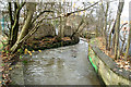
Borsdane Brook
At the bottom of Lowe Mill Lane, just behind Market Street, Hindley.
Image: © David Long
Taken: 24 Nov 2008
0.08 miles
3
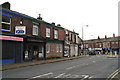
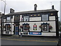
Bridge Street (A58), Hindley
At its junction with Market Street. Some of the premises have been renovated, but the scene is still quite dismal.
Image: © David Long
Taken: 24 Nov 2008
0.09 miles
4
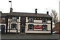
The Lord Nelson, Bridge Street/ Carr Street, Hindley
A handsome old pub, which one hopes will continue to flourish.
Image: © David Long
Taken: 24 Nov 2008
0.10 miles
5
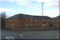
The Acorns Care Home
In the junction of Bridge Street and Castle Hill Road.
Image: © David Long
Taken: 27 Nov 2008
0.10 miles
6
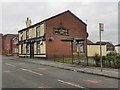
Ellesmere Inn
The Ellesmere Inn on Lancaster Road, Hindley
Image: © David Dixon
Taken: 15 Feb 2012
0.10 miles
7
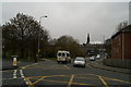
Complicated junction, Hindley
As Bridge Street comes up the hill, it takes an almost right-angle turn as it becomes Castle Hill Road. At the same point Lancaster Street joins, almost in line with Bridge Street, while Chapel Green Road also joins almost on a line with Castle Hill Road. Thus traffic wishing to take either road must indicate its intention to turn right or left (depending on direction of travel) - but, as may be seen from the position of the Ford car, it is by no means clear which road will be turned down until the last minute.
St John's Methodist Church is in the background.
Image: © David Long
Taken: 27 Nov 2008
0.11 miles
8

Buff terracotta in Hindley
Built in 1905 as the Manchester & Salford Bank, later the Royal Bank of Scotland. The retail units to the left originally included the local post office.
Image: © Alan Murray-Rust
Taken: 13 Jun 2023
0.11 miles
9

Hurst Dance Studios, Hindley
Built as the Palace Cinema some time before 1918. Closed as a cinema in 1960.
Image: © Alan Murray-Rust
Taken: 13 Jun 2023
0.12 miles
10
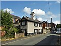
Unusual house on Deansgate
Presumably a house with some age and character and quite different from the more modern houses around
Image: © Kevin Waterhouse
Taken: 17 Aug 2023
0.12 miles