Complicated junction, Hindley
Introduction
The photograph on this page of Complicated junction, Hindley by David Long as part of the Geograph project.
The Geograph project started in 2005 with the aim of publishing, organising and preserving representative images for every square kilometre of Great Britain, Ireland and the Isle of Man.

There are currently over 7.5m images from over 14,400 individuals and you can help contribute to the project by visiting https://www.geograph.org.uk
Complicated junction, Hindley
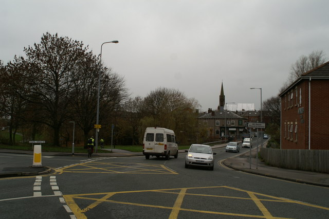
Image: © David Long Taken: 27 Nov 2008
As Bridge Street comes up the hill, it takes an almost right-angle turn as it becomes Castle Hill Road. At the same point Lancaster Street joins, almost in line with Bridge Street, while Chapel Green Road also joins almost on a line with Castle Hill Road. Thus traffic wishing to take either road must indicate its intention to turn right or left (depending on direction of travel) - but, as may be seen from the position of the Ford car, it is by no means clear which road will be turned down until the last minute. St John's Methodist Church is in the background.
Images are licensed for reuse under creativecommons.org/licenses/by-sa/2.0
Image Location
Latitude
53.536854
Longitude
-2.573014