IMAGES TAKEN NEAR TO
Ferry Lane, WAKEFIELD, WF3 4LH
Introduction
This page details the photographs taken nearby to Ferry Lane, WF3 4LH by members of the Geograph project.
The Geograph project started in 2005 with the aim of publishing, organising and preserving representative images for every square kilometre of Great Britain, Ireland and the Isle of Man.

There are currently over 7.5m images from over14,400 individuals and you can help contribute to the project by visiting https://www.geograph.org.uk
Image Map
Images are licensed for reuse under creativecommons.org/licenses/by-sa/2.0
Notes
- Clicking on the map will re-center to the selected point.
- The higher the marker number, the further away the image location is from the centre of the postcode.
Image Listing (102 Images Found)
Images are licensed for reuse under creativecommons.org/licenses/by-sa/2.0
Image
Details
Distance
1
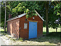
Yorkshire Water building, Ferry Lane, Stanley
Old maps show that Wakefield Corporation had a reservoir adjacent to the road, probably storing water from the Calder; this building may be a relic of that installation, as suggested by a local contributor Image
Image: © Stephen Craven
Taken: 25 May 2020
0.02 miles
3
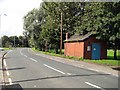
Workshop
This workshop is on the site of a former water works in Ferry Lane. To my knowledge this building has been here for over 60 years, and is still in use today. (Use unknown).
Image: © Mike Kirby
Taken: 10 Sep 2008
0.03 miles
4
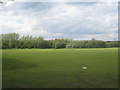
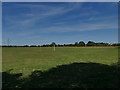
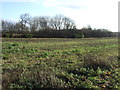
No play today
Playing fields on Ferry Lane, Stanley Ferry.
Image: © Jonathan Thacker
Taken: 8 May 2012
0.03 miles
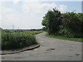
6
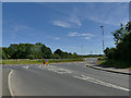
Junction of Ferry Lane and Nellie Spindler Drive
The road to the right was unexpected: it doesn't show on my 2013 Explorer map that only shows a minor road (Balk Lane). It links to the Wakefield Eastern Relief Road that has opened in the last few years. It is named after a local nurse killed in World War One, "the only woman buried with full military honours at Passchendaele".
Image: © Stephen Craven
Taken: 25 May 2020
0.04 miles
8
Playing fields off Ferry Lane, Stanley
This end of the playing fields occupies the site of a former reservoir; the further part, the site of Victoria Colliery.
Image: © Stephen Craven
Taken: 25 May 2020
0.05 miles
10
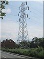
Electricity Pylon No PF15 - Ferry Lane
Image: © Betty Longbottom
Taken: 2 Jun 2014
0.06 miles