IMAGES TAKEN NEAR TO
Long Causeway, WAKEFIELD, WF3 4JD
Introduction
This page details the photographs taken nearby to Long Causeway, WF3 4JD by members of the Geograph project.
The Geograph project started in 2005 with the aim of publishing, organising and preserving representative images for every square kilometre of Great Britain, Ireland and the Isle of Man.

There are currently over 7.5m images from over14,400 individuals and you can help contribute to the project by visiting https://www.geograph.org.uk
Image Map
Images are licensed for reuse under creativecommons.org/licenses/by-sa/2.0
Notes
- Clicking on the map will re-center to the selected point.
- The higher the marker number, the further away the image location is from the centre of the postcode.
Image Listing (118 Images Found)
Images are licensed for reuse under creativecommons.org/licenses/by-sa/2.0
Image
Details
Distance
2
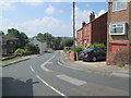
Lee Moor Road - viewed from Long Causeway
Image: © Betty Longbottom
Taken: 23 Jun 2014
0.02 miles
3
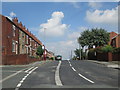
Mount Road - viewed from Long Causeway
Image: © Betty Longbottom
Taken: 23 Jun 2014
0.03 miles
4

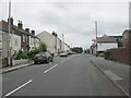
Stanley Methodist Church - Mount Road
Image: © Betty Longbottom
Taken: 8 Apr 2008
0.03 miles
6
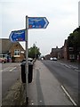
TPT sign Route 67
Situated near the junction of Mount Road and Lake Lock Road.
Image: © Mike Kirby
Taken: 17 Sep 2008
0.04 miles
7
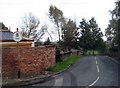
Road bridge
This road bridge on Long Causeway, which crossed the railway, was filled in when the line closed in 1964. Note the weight restriction sign still remains today.
Image: © Mike Kirby
Taken: 8 Oct 2008
0.06 miles
8
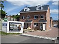
New Housing
It appears that every scrap of land that can be built on, is seeing new housing
being developed. A fair number of houses and apartments have been built on what appeared to be a small plot of land at the eastern end of Gainsborough Way.
Image: © Mike Kirby
Taken: 21 Jul 2008
0.06 miles
9
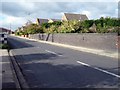
Road bridge
The tram road from Lofthouse to Bottomboat colliery appears to have been used for the rail connections to Stanley station in the mid 19th century. All that now remains as evidence of the railway, which closed in 1964, are the two road bridges in Mount Road and Long Causeway, Image (both filled in).
Image: © Mike Kirby
Taken: 8 Oct 2008
0.07 miles