IMAGES TAKEN NEAR TO
Lindale Lane, WAKEFIELD, WF2 0GZ
Introduction
This page details the photographs taken nearby to Lindale Lane, WF2 0GZ by members of the Geograph project.
The Geograph project started in 2005 with the aim of publishing, organising and preserving representative images for every square kilometre of Great Britain, Ireland and the Isle of Man.

There are currently over 7.5m images from over14,400 individuals and you can help contribute to the project by visiting https://www.geograph.org.uk
Image Map
Images are licensed for reuse under creativecommons.org/licenses/by-sa/2.0
Notes
- Clicking on the map will re-center to the selected point.
- The higher the marker number, the further away the image location is from the centre of the postcode.
Image Listing (42 Images Found)
Images are licensed for reuse under creativecommons.org/licenses/by-sa/2.0
Image
Details
Distance
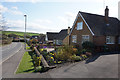
1
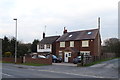
Engine Fold Farm, off Lindale Lane
This isn't the original farmhouse, whose site has been swallowed up by the adjacent pig farm Image
Image: © Stephen Craven
Taken: 15 Oct 2023
0.00 miles
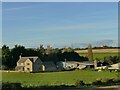
2
Pig farm off Lindale Lane
This looks like a pig farm and is marked as such on the OS map, but didn't smell like one. Perhaps that's because it's disused: a recent article in the Wakefield Express refers to a planning application to redevelop the site for housing.
Image: © Stephen Craven
Taken: 15 Oct 2023
0.06 miles
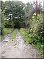
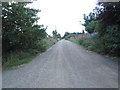
4
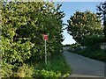
'Road Ahead Closed' sign, Lindale Lane
The lane is a through route for walkers and cyclists but motor traffic is restricted to access to the properties at each end of the road.
Image: © Stephen Craven
Taken: 15 Oct 2023
0.09 miles
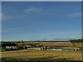
5
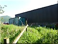
Sheds near FP Stanley 49
Walkers on FP Stanley 49 (Beck Bottom) find themselves staring at the back of two industrial sheds. One or both of these sheds may stand on the definitive line of the footpath.
Image: © Lee Davidson
Taken: 22 May 2012
0.10 miles
7
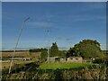
Short wave radio installation on Lindale Lane
Probably used by a radio 'ham'.
Image: © Stephen Craven
Taken: 15 Oct 2023
0.13 miles
9
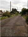
Lindale Lane - viewed from Pippins Green Avenue
Image: © Betty Longbottom
Taken: 3 Sep 2013
0.14 miles