IMAGES TAKEN NEAR TO
Timothy Lane, BATLEY, WF17 0AJ
Introduction
This page details the photographs taken nearby to Timothy Lane, WF17 0AJ by members of the Geograph project.
The Geograph project started in 2005 with the aim of publishing, organising and preserving representative images for every square kilometre of Great Britain, Ireland and the Isle of Man.

There are currently over 7.5m images from over14,400 individuals and you can help contribute to the project by visiting https://www.geograph.org.uk
Image Map
Images are licensed for reuse under creativecommons.org/licenses/by-sa/2.0
Notes
- Clicking on the map will re-center to the selected point.
- The higher the marker number, the further away the image location is from the centre of the postcode.
Image Listing (49 Images Found)
Images are licensed for reuse under creativecommons.org/licenses/by-sa/2.0
Image
Details
Distance
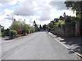
2
The Balk - looking towards Timothy Lane
Image: © Betty Longbottom
Taken: 8 Aug 2012
0.03 miles
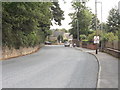
3
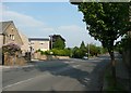
Heaton Road, Batley
The left fork is Timothy Lane, the road to Morley.
Image: © Humphrey Bolton
Taken: 3 Jun 2010
0.04 miles
4
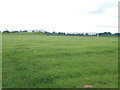
Playing Fields - viewed from The Balk
Image: © Betty Longbottom
Taken: 8 Aug 2012
0.05 miles
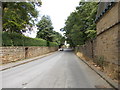
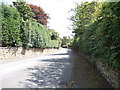
5
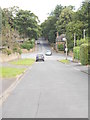
Timothy Lane - viewed from Upper Batley Low Lane
Image: © Betty Longbottom
Taken: 8 Aug 2012
0.05 miles
6
Carlinghow Lane - viewed from Timothy Lane
Image: © Betty Longbottom
Taken: 8 Aug 2012
0.07 miles
7
Upper Batley Low Lane - Timothy Lane
Image: © Betty Longbottom
Taken: 8 Aug 2012
0.07 miles
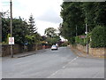
9
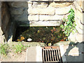
Horse Trough, Upper Batley Low Lane, Upper Batley
This horse trough is in the wall of Marshfield, a large house in the area.
Image: © Gary Hughes
Taken: 3 Jun 2007
0.08 miles
10
Timothy Lane - viewed from Heaton Road
Image: © Betty Longbottom
Taken: 8 Aug 2012
0.08 miles