
IMAGES TAKEN NEAR TO
Tuke Grove, WAKEFIELD, WF1 4SL
Introduction
This page details the photographs taken nearby to Tuke Grove, WF1 4SL by members of the Geograph project.
The Geograph project started in 2005 with the aim of publishing, organising and preserving representative images for every square kilometre of Great Britain, Ireland and the Isle of Man.

There are currently over 7.5m images from over14,400 individuals and you can help contribute to the project by visiting https://www.geograph.org.uk
Image Map
Images are licensed for reuse under creativecommons.org/licenses/by-sa/2.0
Notes
- Clicking on the map will re-center to the selected point.
- The higher the marker number, the further away the image location is from the centre of the postcode.
Image Listing (133 Images Found)
Images are licensed for reuse under creativecommons.org/licenses/by-sa/2.0
Image
Details
Distance
1
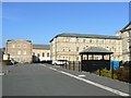
Residential blocks
Recently constructed residential apartment blocks have been designed to blend in sympathetically with the older building (seen in the background). This development is on the site of the former West Riding Pauper Lunatic Asylum, which later became Stanley Royd hospital and is adjacent to Pinderfields Hospital.
Image: © James Allan
Taken: 31 Mar 2008
0.03 miles
2
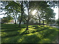
Early morning sun, Parklands, Wakefield
A recent decision to mow only parallel strips on this slope has increased local people's enjoyment of it. Formerly this was part of the grounds of the West Riding Pauper Lunatic Asylum.
Image: © Christine Johnstone
Taken: 10 Jun 2023
0.05 miles
4
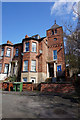
Green Mount Villa dated 1877
Belgrave Terrace, Wakefield.
Image: © Ian S
Taken: 18 Apr 2018
0.06 miles
5
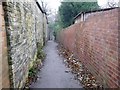
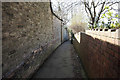
Long Causeway, looking south
The high stone wall was built to guard the grounds of the West Riding Pauper Lunatic Asylum, later Stanley Royd Hospital, now Parklands housing development.
Image: © Christine Johnstone
Taken: 6 Nov 2009
0.07 miles
6
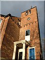
Green Mount Villa 1877
I love a good tower or turret and the position of this one, at the top of Long Causeway, must give a superb view over Wakefield. There is some pretty odd architecture there too, from the Greek temple style entrance, through the diagonal brickwork, the brick guttering supports with no guttering, and the seemingly pointless metal brackets hanging off the side - over a public space. And there is some interesting metal ornamentation right on the top that does not seem to be the expected weather vane.
As a special bonus there is also a UFO.
Image: © John Goldsmith
Taken: 26 Dec 2011
0.07 miles
7
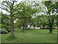
Parklands trees, Wakefield
The former grounds of the West Riding Pauper Lunatic Asylum [later Stanley Royd Hospital]. The housing development on the site is called Parklands.
Image: © Christine Johnstone
Taken: 5 May 2020
0.07 miles
8
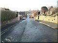
Belgrave Mount - looking towards Eastmoor Road
Image: © Betty Longbottom
Taken: 2 Jan 2014
0.07 miles
9
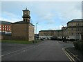
Old and new, Tuke Grove, Wakefield
The clock tower and the larger block of flats were originally part of the West Riding Pauper Lunatic Asylum [later Stanley Royd Hospital, now Parklands]. The small block of flats was built as part of the Parklands development and the larger red brick building is part of the PFI Pinderfields Hospital.
Image: © Christine Johnstone
Taken: 18 Feb 2021
0.08 miles
10
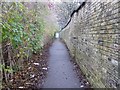
Long Causeway, looking north
Long Causeway was the 'coffin way' from Stanley to Wakefield, before Stanley got its own church and burial ground.
Image: © Christine Johnstone
Taken: 6 Nov 2009
0.08 miles