IMAGES TAKEN NEAR TO
West Royd Drive, MIRFIELD, WF14 9LP
Introduction
This page details the photographs taken nearby to West Royd Drive, WF14 9LP by members of the Geograph project.
The Geograph project started in 2005 with the aim of publishing, organising and preserving representative images for every square kilometre of Great Britain, Ireland and the Isle of Man.

There are currently over 7.5m images from over14,400 individuals and you can help contribute to the project by visiting https://www.geograph.org.uk
Image Map
Images are licensed for reuse under creativecommons.org/licenses/by-sa/2.0
Notes
- Clicking on the map will re-center to the selected point.
- The higher the marker number, the further away the image location is from the centre of the postcode.
Image Listing (86 Images Found)
Images are licensed for reuse under creativecommons.org/licenses/by-sa/2.0
Image
Details
Distance
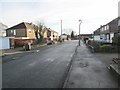
1
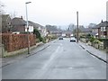
West Royd Drive - Water Royd Avenue
Image: © Betty Longbottom
Taken: 25 Mar 2014
0.03 miles
2
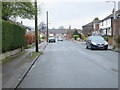
West Royd Drive - West Royd Avenue
Image: © Betty Longbottom
Taken: 25 Mar 2014
0.04 miles
3
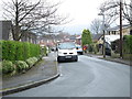
West Royd Park - Water Royd Avenue
Image: © Betty Longbottom
Taken: 25 Mar 2014
0.04 miles
4
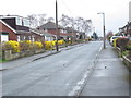
Water Royd Avenue - viewed from West Royd Drive
Image: © Betty Longbottom
Taken: 25 Mar 2014
0.04 miles
6
West Royd Grove - West Royd Avenue
Image: © Betty Longbottom
Taken: 25 Mar 2014
0.06 miles
7
Westroyd House, Water Hall Lane, Mirfield
A Christadelphian rest home.
Image: © Humphrey Bolton
Taken: 26 Mar 2012
0.06 miles
8
Stonehurst Road - Water Royd Avenue
Image: © Betty Longbottom
Taken: 17 Dec 2013
0.07 miles
9
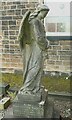
Angel in the burial ground of Zion Baptist Chapel, Mirfield
This memorial was erected in 1894 and restored in 2002.
Image: © Humphrey Bolton
Taken: 24 Aug 2023
0.08 miles
10
Water Royd Drive - Water Royd Avenue
Image: © Betty Longbottom
Taken: 17 Dec 2013
0.09 miles