IMAGES TAKEN NEAR TO
Foxroyd Drive, MIRFIELD, WF14 9ET
Introduction
This page details the photographs taken nearby to Foxroyd Drive, WF14 9ET by members of the Geograph project.
The Geograph project started in 2005 with the aim of publishing, organising and preserving representative images for every square kilometre of Great Britain, Ireland and the Isle of Man.

There are currently over 7.5m images from over14,400 individuals and you can help contribute to the project by visiting https://www.geograph.org.uk
Image Map
Images are licensed for reuse under creativecommons.org/licenses/by-sa/2.0
Notes
- Clicking on the map will re-center to the selected point.
- The higher the marker number, the further away the image location is from the centre of the postcode.
Image Listing (94 Images Found)
Images are licensed for reuse under creativecommons.org/licenses/by-sa/2.0
Image
Details
Distance
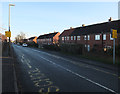
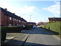
1
Woodsome Drive - Kitson Hill Crescent
Image: © Betty Longbottom
Taken: 21 Dec 2013
0.03 miles

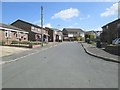
3
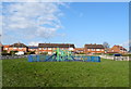
Children's playground on Fox Royd Drive, Mirfield
Image: © JThomas
Taken: 6 Mar 2020
0.03 miles
6
Woodsome Drive - Kitson Hill Crescent
Image: © Betty Longbottom
Taken: 21 Dec 2013
0.06 miles
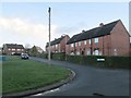
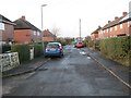
7
Norman Drive - viewed from Norman Road
Image: © Betty Longbottom
Taken: 8 Apr 2014
0.06 miles
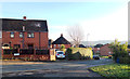
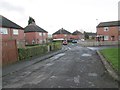
9
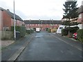
Fox Royd Drive - off Kitson Hill Crescent
Image: © Betty Longbottom
Taken: 21 Dec 2013
0.07 miles