
IMAGES TAKEN NEAR TO
Granny Lane, MIRFIELD, WF14 8LA
Introduction
This page details the photographs taken nearby to Granny Lane, WF14 8LA by members of the Geograph project.
The Geograph project started in 2005 with the aim of publishing, organising and preserving representative images for every square kilometre of Great Britain, Ireland and the Isle of Man.

There are currently over 7.5m images from over14,400 individuals and you can help contribute to the project by visiting https://www.geograph.org.uk
Image Map
Images are licensed for reuse under creativecommons.org/licenses/by-sa/2.0
Notes
- Clicking on the map will re-center to the selected point.
- The higher the marker number, the further away the image location is from the centre of the postcode.
Image Listing (116 Images Found)
Images are licensed for reuse under creativecommons.org/licenses/by-sa/2.0
Image
Details
Distance

2

Granny Lane at the bend, Hopton Bottom, Mirfield (SE204191)
Hopton Bottom is the name on the 1850 map for a group of buildings here. The house on the left is called The Old Forge. The bend is at the Y-shaped junction with a footpath on the right that used to be a lane leading to some of the buildings of the hamlet, and perhaps originated when the road was no more than a pack-horse track.
Image: © Humphrey Bolton
Taken: 28 Feb 2006
0.02 miles

4

Granny Lane - viewed from Hopton Lane
Image: © Betty Longbottom
Taken: 4 Oct 2010
0.02 miles
5

Granny Lane
Houses along Granny Lane in Mirfield.
Image: © DS Pugh
Taken: 22 Feb 2025
0.03 miles
6
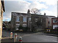
Old houses on Granny Lane
The road does a dog-leg bend round these houses, which may therefore pre-date at least the macadamising of the road. The location is also known as Hopton Bottom.
There is a sign for a public footpath in front of the houses, which leads across fields in the direction of Whitley.
Image: © Stephen Craven
Taken: 14 Jan 2017
0.03 miles
7
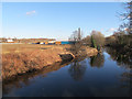
River Calder downstream of Hopton Bridge
The chimney belongs to the disused Holme Bank Mills (now a Business Park). Compare Image
Image: © Stephen Craven
Taken: 14 Jan 2017
0.03 miles
8

River Calder from Hopton New Road
The chimney is part of Holme Bank Mills.
Image: © DS Pugh
Taken: 22 Feb 2025
0.03 miles
9

Hopton Lane
On the right Hopton New Lane crosses the River Calder.
Image: © DS Pugh
Taken: 22 Feb 2025
0.04 miles
10

River Calder - Hopton New Road, Lower Hopton
Image: © Betty Longbottom
Taken: 19 Jul 2008
0.04 miles