IMAGES TAKEN NEAR TO
Shill Bank Lane, MIRFIELD, WF14 0QP

Introduction

This page details the photographs taken nearby to Shill Bank Lane, WF14 0QP by members of the Geograph project.

The Geograph project started in 2005 with the aim of publishing, organising and preserving representative images for every square kilometre of Great Britain, Ireland and the Isle of Man.

There are currently over 7.5m images from over14,400 individuals and you can help contribute to the project by visiting https://www.geograph.org.uk

Image Map


Images are licensed for reuse under creativecommons.org/licenses/by-sa/2.0
Notes
  • Clicking on the map will re-center to the selected point.
  • The higher the marker number, the further away the image location is from the centre of the postcode.

Image Listing (48 Images Found)

Images are licensed for reuse under creativecommons.org/licenses/by-sa/2.0
  • ...
Image
Details
Distance
1
Shill Bank Lane Junction, Northorpe
The original Shill Bank Lane continues straight ahead. The diversion to the left was constructed to avoid a surface level crossing with the L&Y Railway, Mirfield branch railway line.
Image: © Richard Kay Taken: 15 Jan 2009
0.03 miles
2
Shill Bank Avenue - Shill Bank Lane
Image: © Betty Longbottom Taken: 18 Mar 2014
0.05 miles
3
Eastfield Road - Shill Bank Lane
Image: © Betty Longbottom Taken: 18 Mar 2014
0.05 miles
4
Northorpe Working Men's Club - Eastfield Road
Image: © Betty Longbottom Taken: 18 Mar 2014
0.07 miles
5
Remains of railway bridge on Shillbank Lane, Mirfield
Image: © JThomas Taken: 6 Mar 2020
0.07 miles
6
Stoney Lane - Shill Bank Lane
Image: © Betty Longbottom Taken: 18 Mar 2014
0.07 miles
7
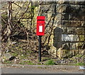
Elizabeth II postbox on Shillbank Lane, Mirfield
Postbox No. WF14 177.
Image: © JThomas Taken: 6 Mar 2020
0.08 miles
8
Shill Bank Lane - off North Road
Image: © Betty Longbottom Taken: 18 Mar 2014
0.08 miles
9
Northorpe LNWR railway station (site), Yorkshire
Opened in 1900 by the London & North Western Railway on their Spen Valley "New" line from Huddersfield to Leeds. View north east from Shillbank Lane. The station was built entirely of wood, including wooden-covered walkways from road level up to the platforms, and it burned down in 1922. It was replaced by Northorpe Higher station out of view to the left of the road bridge.
Image: © Nigel Thompson Taken: 28 Dec 2013
0.08 miles
10
Spring Place Court - looking towards Spring Place Gardens
Image: © Betty Longbottom Taken: 18 Mar 2014
0.09 miles
  • ...