
IMAGES TAKEN NEAR TO
Ladywood Way, DEWSBURY, WF13 3SG
Introduction
This page details the photographs taken nearby to Ladywood Way, WF13 3SG by members of the Geograph project.
The Geograph project started in 2005 with the aim of publishing, organising and preserving representative images for every square kilometre of Great Britain, Ireland and the Isle of Man.

There are currently over 7.5m images from over14,400 individuals and you can help contribute to the project by visiting https://www.geograph.org.uk
Image Map
Images are licensed for reuse under creativecommons.org/licenses/by-sa/2.0
Notes
- Clicking on the map will re-center to the selected point.
- The higher the marker number, the further away the image location is from the centre of the postcode.
Image Listing (124 Images Found)
Images are licensed for reuse under creativecommons.org/licenses/by-sa/2.0
Image
Details
Distance
1

Old Boundary Marker on Greenwood Cut, Calder and Hebble Navigation
Canal Boundary Marker on the north side of Greenwood Cut on the Calder and Hebble Navigation at Ravensthorpe, Dewsbury. B W B (British Waterways Board) in raised lettering. One of six along the Cut.
Milestone Society National ID: YW_CHDEWS04em
Image: © D Garside
Taken: 17 Dec 2020
0.02 miles
2

Old Boundary Marker on Greenwood Cut, Calder and Hebble Navigation
Canal Boundary Marker on the north side of Greenwood Cut on the Calder and Hebble Navigation at Ravensthorpe, Dewsbury. B W B (British Waterways Board) in raised lettering. One of six along the Cut.
Milestone Society National ID: YW_CHDEWS03em
Image: © D Garside
Taken: 17 Dec 2020
0.03 miles
3

Old Boundary Marker on Greenwood Cut, Calder and Hebble Navigation
Canal Boundary Marker on the north side of Greenwood Cut on the Calder and Hebble Navigation at Ravensthorpe, Dewsbury. B W B (British Waterways Board) in raised lettering. One of six along the Cut.
Milestone Society National ID: YW_CHDEWS05em
Image: © D Garside
Taken: 17 Dec 2020
0.04 miles
4

Old Boundary Marker on Greenwood Cut, Calder and Hebble Navigation
Canal Boundary Marker on the north side of Greenwood Cut on the Calder and Hebble Navigation at Ravensthorpe, Dewsbury. B W B (British Waterways Board) in raised lettering. One of six along the Cut.
Milestone Society National ID: YW_CHDEWS02em
Image: © D Garside
Taken: 17 Dec 2020
0.05 miles

6

Old Boundary Marker on Greenwood Cut, Calder and Hebble Navigation
Canal Boundary Marker on the north side of Greenwood Cut on the Calder and Hebble Navigation at Ravensthorpe, Dewsbury. B W B (British Waterways Board) in raised lettering. One of six along the Cut.
Milestone Society National ID: YW_CHDEWS06em
Image: © D Garside
Taken: 17 Dec 2020
0.07 miles
7

Timber pallets in a yard alongside Greenwood Cut
The site appears to be the premises of Frame Tech Structures.
Image: © Stephen Craven
Taken: 17 Jun 2017
0.09 miles
8
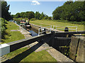
Greenwood Lock (1)
The lock gives boats on the Calder and Hebble Navigation access to the Greenwood Cut which bypasses the weir at Low Mill Lane. It is a grade 2 listed structure (list entry 1134720, where it is described as dating from circa 1769, by the noted canal engineer John Smeaton).
Image: © Stephen Craven
Taken: 17 Jun 2017
0.10 miles
9

Greenwood Lock 16 from above
Calder and Hebble Canal - at the lower end of Grenwood Cut
Image: © Mike Todd
Taken: 18 Jun 2011
0.11 miles
10

Greenwood Lock 16 from below
Calder and Hebble Canal - as the navigation joins with Greenwood Cut above the lock
Image: © Mike Todd
Taken: 18 Jun 2011
0.11 miles