
IMAGES TAKEN NEAR TO
Fir Avenue, DEWSBURY, WF13 3BN
Introduction
This page details the photographs taken nearby to Fir Avenue, WF13 3BN by members of the Geograph project.
The Geograph project started in 2005 with the aim of publishing, organising and preserving representative images for every square kilometre of Great Britain, Ireland and the Isle of Man.

There are currently over 7.5m images from over14,400 individuals and you can help contribute to the project by visiting https://www.geograph.org.uk
Image Map
Images are licensed for reuse under creativecommons.org/licenses/by-sa/2.0
Notes
- Clicking on the map will re-center to the selected point.
- The higher the marker number, the further away the image location is from the centre of the postcode.
Image Listing (124 Images Found)
Images are licensed for reuse under creativecommons.org/licenses/by-sa/2.0
Image
Details
Distance
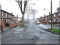
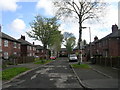
3
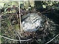
Old milemarker by the Calder & Hebble Navigation, Shepley Bridge
Milemarker by the Calder & Hebble Navigation, in parish of Dewsbury (Kirklees District), Shepley Bridge.
Surveyed
Milestone Society National ID: CHN-10
Image: © Milestone Society
Taken: Unknown
0.05 miles
4

Junction of Low Mill Lane and Huddersfield Road
The green oval hides something interesting Image
Image: © Stephen Craven
Taken: 17 Jun 2017
0.05 miles
5
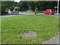
Overflow location
This wide area between the river wall and main road was found to be the best location for an overflow chamber (see shared description). This contains an overflow weir that spills excess flows from the sewer tunnel some 10 metres below into a 1m diameter storm sewer that discharges to the river below Greenwood Lock. The approximately 2km of 1.8m diameter tunnel was designed to act as storm storage within the system, so that the overflow should only have to operate on overage once or twice a year after extreme rainfall. Previously there were several smaller overflows in the area that discharged raw sewage to the river rather more often.
For a wider context, see Image
Image: © Stephen Craven
Taken: 17 Jun 2017
0.05 miles
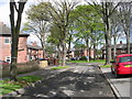
7
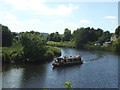
Boat on the Calder by Low Mill Lane
The canal boat is on part of the Calder and Hebble Navigation that uses the river itself, but is approaching Greenwood Cut (a short stretch of artificial canal).
Image: © Stephen Craven
Taken: 17 Jun 2017
0.06 miles
8
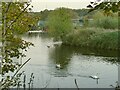
Swans on the Calder at Shepley Bridge
Image: © Stephen Craven
Taken: 7 Nov 2021
0.07 miles
9
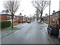
Fir Parade - looking towards Huddersfield Road
Image: © Betty Longbottom
Taken: 18 Mar 2014
0.07 miles
