IMAGES TAKEN NEAR TO
The Crescent, DEWSBURY, WF13 3BB
Introduction
This page details the photographs taken nearby to The Crescent, WF13 3BB by members of the Geograph project.
The Geograph project started in 2005 with the aim of publishing, organising and preserving representative images for every square kilometre of Great Britain, Ireland and the Isle of Man.

There are currently over 7.5m images from over14,400 individuals and you can help contribute to the project by visiting https://www.geograph.org.uk
Image Map
Images are licensed for reuse under creativecommons.org/licenses/by-sa/2.0
Notes
- Clicking on the map will re-center to the selected point.
- The higher the marker number, the further away the image location is from the centre of the postcode.
Image Listing (131 Images Found)
Images are licensed for reuse under creativecommons.org/licenses/by-sa/2.0
Image
Details
Distance
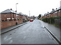
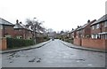
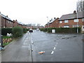
3
Fir Parade - looking towards Huddersfield Road
Image: © Betty Longbottom
Taken: 18 Mar 2014
0.05 miles
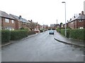
5
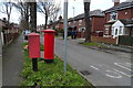
Fir Parade, Ravensthorpe
Showing position of Postbox No. WF13 58.
See Image] for postbox.
Image: © JThomas
Taken: 6 Mar 2020
0.06 miles
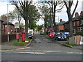
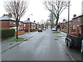
8
Lee Road - viewed from The Crescent
Image: © Betty Longbottom
Taken: 18 Mar 2014
0.06 miles
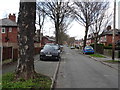
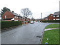
10
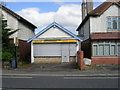
Star Express Takeaway - Huddersfield Road
Image: © Betty Longbottom
Taken: 1 May 2010
0.07 miles