
IMAGES TAKEN NEAR TO
The Crescent, DEWSBURY, WF13 3AZ
Introduction
This page details the photographs taken nearby to The Crescent, WF13 3AZ by members of the Geograph project.
The Geograph project started in 2005 with the aim of publishing, organising and preserving representative images for every square kilometre of Great Britain, Ireland and the Isle of Man.

There are currently over 7.5m images from over14,400 individuals and you can help contribute to the project by visiting https://www.geograph.org.uk
Image Map
Images are licensed for reuse under creativecommons.org/licenses/by-sa/2.0
Notes
- Clicking on the map will re-center to the selected point.
- The higher the marker number, the further away the image location is from the centre of the postcode.
Image Listing (70 Images Found)
Images are licensed for reuse under creativecommons.org/licenses/by-sa/2.0
Image
Details
Distance

3

Playing Fields - Holroyd Park - off The Crescent
Image: © Betty Longbottom
Taken: 18 Mar 2014
0.08 miles
6
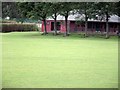
Holroyd Park sports pavilion
A red brick built pavilion at the top end of the football pitch, near bowling greens. Amenities include a children's playground. This park borders a council estate and some waste ground.
From memory, I think there was a disused mine close-by. Children used to play on the 'pit hills' many years ago (approx. 50 years).
This is one of 2 parks in Ravensthorpe, the other being a very small one opposite the end of North Road on the main Huddersfield Road approx one mile away.
Image: © Chris Pattinson
Taken: 27 Aug 2011
0.10 miles
7

Calder Valley greenway passes through Holroyd Park
Image: © Steve Fareham
Taken: 21 Jun 2016
0.10 miles
9
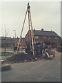
Dewatering point
A sewer tunnel passes under Lee Road. It order to build it the sandy soil had to be de-watered, and this percussion drilling rig is installing the dewatering pump.
Image: © Stephen Craven
Taken: 17 Apr 1985
0.12 miles
10
Fir Parade - looking towards Huddersfield Road
Image: © Betty Longbottom
Taken: 18 Mar 2014
0.12 miles