
IMAGES TAKEN NEAR TO
North Road, DEWSBURY, WF13 3AD
Introduction
This page details the photographs taken nearby to North Road, WF13 3AD by members of the Geograph project.
The Geograph project started in 2005 with the aim of publishing, organising and preserving representative images for every square kilometre of Great Britain, Ireland and the Isle of Man.

There are currently over 7.5m images from over14,400 individuals and you can help contribute to the project by visiting https://www.geograph.org.uk
Image Map
Images are licensed for reuse under creativecommons.org/licenses/by-sa/2.0
Notes
- Clicking on the map will re-center to the selected point.
- The higher the marker number, the further away the image location is from the centre of the postcode.
Image Listing (191 Images Found)
Images are licensed for reuse under creativecommons.org/licenses/by-sa/2.0
Image
Details
Distance
1
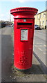
Elizabeth II postbox on North Road, Ravensthorpe
Postbox No. WF13 57.
See Image] for context.
Image: © JThomas
Taken: 6 Mar 2020
0.01 miles

3
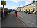
North Road, Ravensthorpe
Showing position of Postbox No. WF13 57.
See Image] for postbox.
Image: © JThomas
Taken: 6 Mar 2020
0.02 miles
6
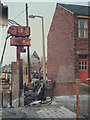
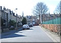
Pile driving for a sewer shaft
See the shared description: In order to construct a sewer tunnel by the pipe-jacking technique, the contractor had to use steel sheet piles to make a large rectangular working shaft for the jacks and other equipment. A vibrational method was used, rather than the traditional drop-hammer, to minimise disturbance to nearby properties.
The house shown here appears no longer to be present, although the garden wall remains to confirm the location on revisiting the street.
Image: © Stephen Craven
Taken: 29 Apr 1985
0.04 miles
7
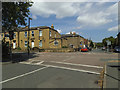
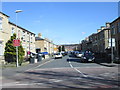
Junction of Myrtle Street, Sackville Street and North Road
Myrtle Road in the foreground, North Road running across and Sackville Street beyond. This is on National Cycle Network Route 66.
See the shared description "Revisiting Ravensthorpe": the location of the pile driving shown in Image is about where the red car is in this view. It took me a while to pin down as the gable end of the house shown in the older photo is not longer there. But the garden walls are still there and helped fix it.
Image: © Stephen Craven
Taken: 17 Jun 2017
0.04 miles

9
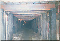
Temporary timber heading
In constructing a sewer by the pipe-jacking method, the 'shield' at the front got stuck, and had to be rescued by a temporary hand-dug tunnel back from the next construction shaft. It had to be close-boarded with timber to keep out the sandy ground. [the location is approximate but within +/- 200m].
Image: © Stephen Craven
Taken: 5 Sep 1985
0.05 miles
10
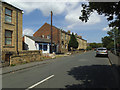
Sackville Street east of North Road
With a closed shop on the left side. This is on National Cycle Network Route 66.
Image: © Stephen Craven
Taken: 17 Jun 2017
0.05 miles