
IMAGES TAKEN NEAR TO
Bradford Road, DEWSBURY, WF13 2DS
Introduction
This page details the photographs taken nearby to Bradford Road, WF13 2DS by members of the Geograph project.
The Geograph project started in 2005 with the aim of publishing, organising and preserving representative images for every square kilometre of Great Britain, Ireland and the Isle of Man.

There are currently over 7.5m images from over14,400 individuals and you can help contribute to the project by visiting https://www.geograph.org.uk
Image Map
Images are licensed for reuse under creativecommons.org/licenses/by-sa/2.0
Notes
- Clicking on the map will re-center to the selected point.
- The higher the marker number, the further away the image location is from the centre of the postcode.
Image Listing (661 Images Found)
Images are licensed for reuse under creativecommons.org/licenses/by-sa/2.0
Image
Details
Distance
1
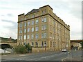
Spinkwell Mill, Halifax Road, Dewsbury
According to a blue plaque on the building, 'a carding and scribbling mill existed at Spinkwell from the early 1800s'. This building, representing only part of the full extent of the mill, was built in 1910. It closed in 1959; it has now been converted to 100 'luxury' apartments.
Image: © Stephen Craven
Taken: 4 Sep 2022
0.01 miles
2
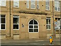
Blocked entrance to Spinkwell Mill, Halifax Road, Dewsbury
According to the blue plaque seen left, 'a carding and scribbling mill existed at Spinkwell from the early 1800s'. This building, representing only part of the full extent of the mill, was built in 1910. It closed in 1959; it has now been converted to 100 'luxury' apartments. See Image for a wider view.
Image: © Stephen Craven
Taken: 4 Sep 2022
0.01 miles
3
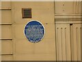
Blue plaque on Spinkwell Mill
According to the blue plaque 'a carding and scribbling mill existed at Spinkwell from the early 1800s'. This building, representing only part of the full extent of the mill, was built in 1910. It closed in 1959; it has now been converted to 100 'luxury' apartments. See Image for a wider view.
Image: © Stephen Craven
Taken: 4 Sep 2022
0.01 miles
4
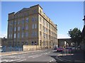
Spinkwell Mill, Halifax Road, Dewsbury
This is the last remaining part of a large block of mills between Bradford Road and Halifax Road. The other part was redeveloped as a supermarket. This early 20C building became South's furniture store before being converted to apartments. The Ordnance Survey has the name as Spinkwell (1850 and 1907),
a nearby road is Spinkwell Road, the blue plaque next to the former doorway has Spinkwell; however someone asked for it to be changed to "Sprinkwell". I have changed it back again in view of the above evidence.
Image: © Humphrey Bolton
Taken: 24 Aug 2006
0.02 miles
5
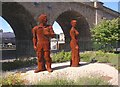
Sculpture, Dewsbury Ring Road
This must be one of those conversation pieces; guess what the two characters are saying to each other!
Image: © Humphrey Bolton
Taken: 24 Aug 2006
0.02 miles
6
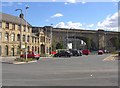
The railway bridge, Bradford Road, Dewsbury
This is part of the viaduct across the valley of Batley Beck. The car park for the Lidl store is in the foreground, and some late 19C office buildings are on the left.
Image: © Humphrey Bolton
Taken: 24 Aug 2006
0.02 miles
7
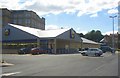
Lidl store, Bradford Road, Dewsbury
Built on half of the former Safeway site. Larger than the Lidl at Mirfield that I am used to, but eventually I found my favourite chocolate!
Image: © Humphrey Bolton
Taken: 24 Aug 2006
0.02 miles
8
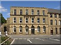
Office building, Bradford Road, Dewsbury
Victorian architecture is now being appreciated again. Here the ground floor has been faced with shaped ashlar blocks, and central bays are accentuated by different types of window head: carved animal heads on the ground floor, entablature on the first floor and keystones on the second floor.
Image: © Humphrey Bolton
Taken: 24 Aug 2006
0.02 miles
9
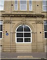
Doorway of Spinkwell Mill, Halifax Road, Dewsbury
The blue plaque reads ”Mark Oldroyd & Sons / Spinkwell Mill / A carding and Scribbling mill existed at Spinkwell from the early 1800s. Oldroyds became one of the World's largest cloth manufacturers with mills in Dewsbury, Leeds, Germany and Silesia. Sir mark Oldroyd (1843-1916) was Dewsbury's mayor 1887-8 and Liberal MP 1888-1901. The company closed in 1959.” The date on the keystone is 1910.
Image: © Humphrey Bolton
Taken: 15 Mar 2007
0.02 miles
10
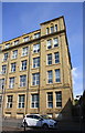
Spinkwell Mill viewed across Halifax Road (A638)
There is an OS benchmark Image on the right hand (in shade) side of the mill building, near its front corner
Image: © Roger Templeman
Taken: 30 Aug 2018
0.02 miles