
IMAGES TAKEN NEAR TO
Daisy Hill, DEWSBURY, WF13 1LT
Introduction
This page details the photographs taken nearby to Daisy Hill, WF13 1LT by members of the Geograph project.
The Geograph project started in 2005 with the aim of publishing, organising and preserving representative images for every square kilometre of Great Britain, Ireland and the Isle of Man.

There are currently over 7.5m images from over14,400 individuals and you can help contribute to the project by visiting https://www.geograph.org.uk
Image Map
Images are licensed for reuse under creativecommons.org/licenses/by-sa/2.0
Notes
- Clicking on the map will re-center to the selected point.
- The higher the marker number, the further away the image location is from the centre of the postcode.
Image Listing (799 Images Found)
Images are licensed for reuse under creativecommons.org/licenses/by-sa/2.0
Image
Details
Distance
2
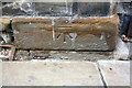
Benchmark on #74 Daisy Hill
Ordnance Survey cut mark benchmark described on the Bench Mark Database at www.bench-marks.org.uk/bm109651
Image: © Luke Shaw
Taken: 5 Sep 2018
0.01 miles

4
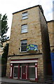
#74 Daisy Hill, Methodist Resource Centre
There is an OS benchmark Image on the base stone at the right hand front of the building, left of stone steps
Image: © Luke Shaw
Taken: 5 Sep 2018
0.01 miles
5
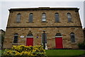
Central Methodist Church
On Daisy Hill, Dewsbury.http://www.geograph.org.uk/photo/3963549
Image: © Ian S
Taken: 30 Apr 2014
0.02 miles
6
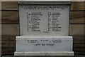
War Memorial, Central Methodist Church
On Daisy Hill, Dewsbury. http://www.geograph.org.uk/photo/3963542
Image: © Ian S
Taken: 30 Apr 2014
0.02 miles
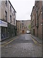
8
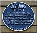
Blue plaque, Central Methodist Church
On Daisy Hill, Dewsbury.http://www.geograph.org.uk/photo/3963542
Image: © Ian S
Taken: 30 Apr 2014
0.03 miles
9

Elim church, Dewsbury
Built in 1839 as Centenary Church eventually becoming the Central Methodist Church and now Elim Pentecostal Church https://www.britishlistedbuildings.co.uk/101134733-central-methodist-church-dewsbury-east-ward#.Wo3ZgOfLjVI
Image: © Jonathan Thacker
Taken: 19 Feb 2018
0.03 miles
10
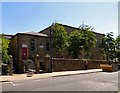
Elim Pentecostal Church
The Wellington Street entrance to Elim church. The Grade II listed building https://historicengland.org.uk/listing/the-list/list-entry/1134733 was built in 1839 as a Wesleyan Chapel. It later became known as Daisy Hill Methodist Church and then Central Methodist Church sharing the building for many years with the Elim Pentecostal Church. The Methodists moved out in 2007 and the building was expected to bought by developers. However it was purchased by the Pentecostal Church who now have exclusive use.
Image: © Gerald England
Taken: 28 Jun 2018
0.03 miles