IMAGES TAKEN NEAR TO
Longcauseway, DEWSBURY, WF12 0RG
Introduction
This page details the photographs taken nearby to Longcauseway, WF12 0RG by members of the Geograph project.
The Geograph project started in 2005 with the aim of publishing, organising and preserving representative images for every square kilometre of Great Britain, Ireland and the Isle of Man.

There are currently over 7.5m images from over14,400 individuals and you can help contribute to the project by visiting https://www.geograph.org.uk
Image Map
Images are licensed for reuse under creativecommons.org/licenses/by-sa/2.0
Notes
- Clicking on the map will re-center to the selected point.
- The higher the marker number, the further away the image location is from the centre of the postcode.
Image Listing (42 Images Found)
Images are licensed for reuse under creativecommons.org/licenses/by-sa/2.0
Image
Details
Distance
1
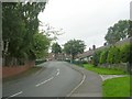
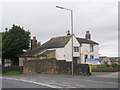
The Long Causeway, Thornhill
descending westward towards the Calder. The name suggest that this is an ancient track.
Image: © Nigel Homer
Taken: 29 Jan 2006
0.03 miles
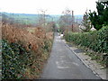
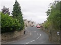
2
Long Causeway Bridleway - Overthorpe Road
Image: © Betty Longbottom
Taken: 5 Aug 2009
0.03 miles
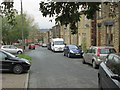
3
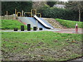
Hilltop Farm Day Nursery - Overthorpe Road
Image: © Betty Longbottom
Taken: 5 Aug 2009
0.10 miles
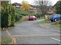
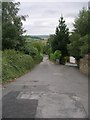
7
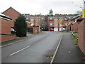
Honeysuckle Drive - Lees Hall Road
Image: © Betty Longbottom
Taken: 11 Nov 2014
0.12 miles