IMAGES TAKEN NEAR TO
Primrose Vale, KNOTTINGLEY, WF11 9BT
Introduction
This page details the photographs taken nearby to Primrose Vale, WF11 9BT by members of the Geograph project.
The Geograph project started in 2005 with the aim of publishing, organising and preserving representative images for every square kilometre of Great Britain, Ireland and the Isle of Man.

There are currently over 7.5m images from over14,400 individuals and you can help contribute to the project by visiting https://www.geograph.org.uk
Image Map
Images are licensed for reuse under creativecommons.org/licenses/by-sa/2.0
Notes
- Clicking on the map will re-center to the selected point.
- The higher the marker number, the further away the image location is from the centre of the postcode.
Image Listing (212 Images Found)
Images are licensed for reuse under creativecommons.org/licenses/by-sa/2.0
Image
Details
Distance
1
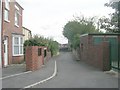
Primrose Vale - viewed from Rope Walk
Image: © Betty Longbottom
Taken: 27 Aug 2010
0.03 miles
2
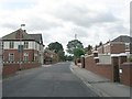
Rope Walk - viewed from Primrose Hill
Image: © Betty Longbottom
Taken: 27 Aug 2010
0.03 miles
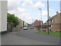
4
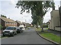
Garden Lane - viewed from Willow Road
Image: © Betty Longbottom
Taken: 27 Aug 2010
0.04 miles
5
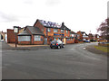
Raising the roof
The gutted building that used to be the Cherrytree public house.
Image: © derek dye
Taken: 28 Mar 2016
0.04 miles
6
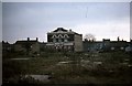
Knottingley United Reformed Church from Aire Street, 1977
Knottingley United Reformed Church is situated at the junction of The Croft (front) and Willows Road (side visible), Knottingley. This view taken in June 1977, is across the Aire Street redevelopment zone, an area behind the former Aire Street shopping area which comprised sub-standard nineteenth century housing in a maze of ginnels and yards. After clearance redevelopment was delayed for years. Aire View, an unimaginative and rather characterless public housing scheme, occupies the wasteland shown, and is now managed by Wakefield District Housing.
Image: © Robert Neilson
Taken: Unknown
0.05 miles
7
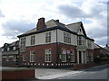
Rope Walk Methodist Church - Rope Walk
Image: © Betty Longbottom
Taken: 27 Aug 2010
0.05 miles
8
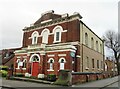
United Reformed Church, Knottingley
A curious building which seems out of character with the area around it, which is mostly mid to late 20th century housing. Old maps reveal that the chapel was here circa 1895 and at that time was at the 'back' of the main part of the town close by open fields and allotment gardens.
Image: © Gordon Hatton
Taken: 30 Dec 2021
0.06 miles
9

Elim Pentecostal Church - Tithe Barn Road
Built in 1882, the building was first occupied by Elim Pentecostal in 1915.
Image: © Betty Longbottom
Taken: 21 Mar 2009
0.06 miles