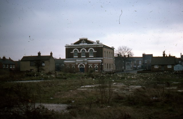
Knottingley United Reformed Church from Aire Street, 1977
Introduction
The photograph on this page of Knottingley United Reformed Church from Aire Street, 1977 by Robert Neilson as part of the Geograph project.
The Geograph project started in 2005 with the aim of publishing, organising and preserving representative images for every square kilometre of Great Britain, Ireland and the Isle of Man.
There are currently over 7.5m images from over 14,400 individuals and you can help contribute to the project by visiting https://www.geograph.org.uk

Image: © Robert Neilson Taken: Unknown
Knottingley United Reformed Church is situated at the junction of The Croft (front) and Willows Road (side visible), Knottingley. This view taken in June 1977, is across the Aire Street redevelopment zone, an area behind the former Aire Street shopping area which comprised sub-standard nineteenth century housing in a maze of ginnels and yards. After clearance redevelopment was delayed for years. Aire View, an unimaginative and rather characterless public housing scheme, occupies the wasteland shown, and is now managed by Wakefield District Housing.

