
IMAGES TAKEN NEAR TO
Eastfield Lane, CASTLEFORD, WF10 4LB
Introduction
This page details the photographs taken nearby to Eastfield Lane, WF10 4LB by members of the Geograph project.
The Geograph project started in 2005 with the aim of publishing, organising and preserving representative images for every square kilometre of Great Britain, Ireland and the Isle of Man.

There are currently over 7.5m images from over14,400 individuals and you can help contribute to the project by visiting https://www.geograph.org.uk
Image Map
Images are licensed for reuse under creativecommons.org/licenses/by-sa/2.0
Notes
- Clicking on the map will re-center to the selected point.
- The higher the marker number, the further away the image location is from the centre of the postcode.
Image Listing (230 Images Found)
Images are licensed for reuse under creativecommons.org/licenses/by-sa/2.0
Image
Details
Distance
1

William Rylatt Carpets - Eastfield Lane
Image: © Betty Longbottom
Taken: 18 Aug 2010
0.00 miles

3
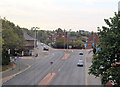
Bridge Street Castleford
From the railway bridge looking towards roundabout to the south
Image: © John Firth
Taken: 18 Aug 2011
0.02 miles
4
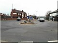
Bridge Street roundabout, Castleford
A busy junction - I had to wait quite a while for a gap in the traffic.
Image: © Stephen Craven
Taken: 21 Mar 2022
0.04 miles
5
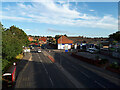
Bridge Street, Castleford
An urban dual carriageway, viewed from a train passing over the railway bridge.
Image: © Stephen Craven
Taken: 20 Aug 2020
0.04 miles
6

Castleford 1st railway station (site), Yorkshire
Opened in 1840 by the York & North Midland Railway, later part of the North Eastern Railway, on the line from York to Normanton, this station closed in 1871 when it was replaced by the current station, some 400m behind the camera position (see Image
View northeast at the site of the entrance building and platforms. At the time the station was open, Bridge Street consisted of only the nearest two lanes. The three storey entrance building would have been in front of the parapet and to the right of the car. It contained stairs up to platform level, the platforms having been on the far side of the bridge. The widening of the road means that no trace of the former station survives. The Normanton-York line was still in use when this image was taken.
Image: © Nigel Thompson
Taken: 27 Feb 2024
0.05 miles
7

Eastfield Lane, Castleford
Hemmed in by the buildings of Fawcett's maltkilns, which supply some of Yorkshire's best-known breweries. Business established in the 1860s by John Austin, whose fortune paid for the nearby St Joseph's Church http://www.geograph.org.uk/photo/239280 and school http://www.geograph.org.uk/photo/532527 in the 1870s.
Image: © David Pickersgill
Taken: 9 Sep 2007
0.05 miles
8

Fawcett's maltkilns, Castleford
View looking west along Eastfield Lane. The brick buildings date from the 1860s, the metal-clad buildings and silos from the 1970s to the 21st century.
Image: © David Pickersgill
Taken: 9 Sep 2007
0.05 miles
9

Pontefract Road - viewed from Ferrybridge Road
Image: © Betty Longbottom
Taken: 18 Aug 2010
0.05 miles
10
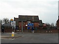
St Joseph's R.C. Academy, Castleford
See also Image for a closer view.
Image: © Stephen Craven
Taken: 21 Mar 2022
0.05 miles