
IMAGES TAKEN NEAR TO
Park Avenue, CASTLEFORD, WF10 2AS
Introduction
This page details the photographs taken nearby to Park Avenue, WF10 2AS by members of the Geograph project.
The Geograph project started in 2005 with the aim of publishing, organising and preserving representative images for every square kilometre of Great Britain, Ireland and the Isle of Man.

There are currently over 7.5m images from over14,400 individuals and you can help contribute to the project by visiting https://www.geograph.org.uk
Image Map
Images are licensed for reuse under creativecommons.org/licenses/by-sa/2.0
Notes
- Clicking on the map will re-center to the selected point.
- The higher the marker number, the further away the image location is from the centre of the postcode.
Image Listing (63 Images Found)
Images are licensed for reuse under creativecommons.org/licenses/by-sa/2.0
Image
Details
Distance
1
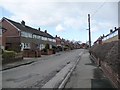
Park Avenue, south side
Older houses in the distance, newer houses nearby. Part of a rectangle of houses between Park Lane and Barnsdale Road.
Image: © Christine Johnstone
Taken: 9 Mar 2011
0.00 miles
2
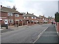
Park Avenue, west side
Part of a rectangle of houses between Park Lane and Barnsdale Road.
Image: © Christine Johnstone
Taken: 9 Mar 2011
0.04 miles
3
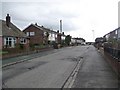
Park Avenue, east side
Part of a rectangle of houses between Park Lane and Barnsdale Road.
Image: © Christine Johnstone
Taken: 9 Mar 2011
0.05 miles
4
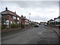
Park Avenue, north side
All the printed maps show that these houses are in SE4227, so I've gone with them. Part of a rectangle of houses between Park Lane and Barnsdale Road.
Image: © Christine Johnstone
Taken: 9 Mar 2011
0.06 miles
5

Substation and garage
To the west of Park Avenue, and for its benefit.
Image: © Christine Johnstone
Taken: 9 Mar 2011
0.09 miles
6
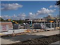
Construction Site - Haigh Moor Way
Image: © Betty Longbottom
Taken: 30 Sep 2016
0.10 miles
7
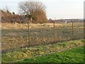
The former Ledston Branch railway line
South-west of Park Avenue, and north of the Millennium housing.
Image: © Christine Johnstone
Taken: 5 Jan 2013
0.10 miles
8

From Colliery Canteen to 21st Century Office
The former headquarters of the Northern Section of the Coal Board, Allerton Bywater, now renovated and turned into spanking brand new offices, housing English Partnerships, the quango tasked to turn the adjoining land into a business park and Millennium Village housing development. This pit was the site of some of the first miners returning to work as the strike of the mid-1980s started to lose support.
Image: © Paul Johnston-Knight
Taken: 30 Sep 2005
0.10 miles
9

Electricity Substation No 48062 - Haigh Moor Way
Image: © Betty Longbottom
Taken: 30 Sep 2016
0.10 miles
10

Bus stops on Park Lane
Park Lane Park Avenue Bus Stops in Allerton Bywater.
Image: © DS Pugh
Taken: 25 Feb 2023
0.10 miles