
IMAGES TAKEN NEAR TO
Owlwood, CASTLEFORD, WF10 2AN
Introduction
This page details the photographs taken nearby to Owlwood, WF10 2AN by members of the Geograph project.
The Geograph project started in 2005 with the aim of publishing, organising and preserving representative images for every square kilometre of Great Britain, Ireland and the Isle of Man.

There are currently over 7.5m images from over14,400 individuals and you can help contribute to the project by visiting https://www.geograph.org.uk
Image Map
Images are licensed for reuse under creativecommons.org/licenses/by-sa/2.0
Notes
- Clicking on the map will re-center to the selected point.
- The higher the marker number, the further away the image location is from the centre of the postcode.
Image Listing (31 Images Found)
Images are licensed for reuse under creativecommons.org/licenses/by-sa/2.0
Image
Details
Distance
1
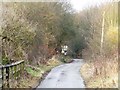
Doctor's Lane, north of The Lines
A private road leading to Owl Wood.
Image: © Christine Johnstone
Taken: 5 Jan 2013
0.07 miles
2
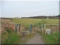
Decision time, north-east of The Lines
The left [north] path goes to Kippax, the cross-field [east] path goes to Owl Wood Cottage. Only the former is mapped as a public footpath.
Image: © Christine Johnstone
Taken: 5 Jan 2013
0.11 miles
3
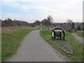
The site of a former railway bridge, on The Lines
Seen from the location of Bowers Halt.
Image: © Christine Johnstone
Taken: 5 Jan 2013
0.11 miles
4
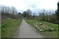
Site of Bowers Railway Station
The Lines Way is a cycle path from Garforth to Allerton Bywater along the former railway line. It is designated as part of National Cycle Network route 697. Information on the line can be found at: https://en.wikipedia.org/wiki/Castleford%E2%80%93Garforth_line and on Bowers Station at: https://en.wikipedia.org/wiki/Bowers_railway_station
Image: © DS Pugh
Taken: 18 Mar 2023
0.12 miles
5
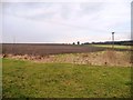
Farmland north-east of The Lines
With Owl Wood on the horizon.
Image: © Christine Johnstone
Taken: 5 Jan 2013
0.13 miles
6
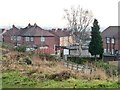
Houses on Westfield Grove
Seen from The Lines, a permitted bridleway on the former Ledston Branch of the Leeds, Castleford & Pontefract Junction railway.
Image: © Christine Johnstone
Taken: 5 Jan 2013
0.13 miles
7
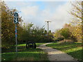
Bowers Junction on the old railway line
At this point the old NER 'Leeds and Castleford' railway headed off to the right in the direction of Garforth where it joined the Leeds to York line, whilst to the left a mineral line led to Lowther Colliery and beyond. Now all this is a cycle and walkway.
Image: © Gordon Hatton
Taken: 25 Nov 2022
0.13 miles
8
![Bowers Junction [once Bowers Halt]](https://s3.geograph.org.uk/geophotos/03/28/32/3283247_36e7d413_120x120.jpg)
Bowers Junction [once Bowers Halt]
Formerly the junction of the Ledston branch of the Leeds, Castleford & Pontefract Junction railway [straight ahead / north]and the Allerton Main collieries line [left / west]. Now a path junction on The Lines, a permitted bridleway.
Image: © Christine Johnstone
Taken: 5 Jan 2013
0.13 miles
9
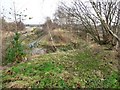
A missing bridge at Doctor's Lane
The former Ledston branch railway line had a bridge here. The permitted bridleway, The Lines, does not.
Image: © Christine Johnstone
Taken: 5 Jan 2013
0.14 miles
10
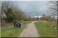
Junction on Lines Way
The Lines Way is a cycle path from Garforth to Allerton Bywater along the former railway line. It is designated as part of National Cycle Network route 697. The main route runs to the right with former colliery lines heading to the left. Both routes are accessible for cyclists and walkers.
Image: © DS Pugh
Taken: 18 Mar 2023
0.14 miles