
IMAGES TAKEN NEAR TO
Brigantia View, CASTLEFORD, WF10 1FG
Introduction
This page details the photographs taken nearby to Brigantia View, WF10 1FG by members of the Geograph project.
The Geograph project started in 2005 with the aim of publishing, organising and preserving representative images for every square kilometre of Great Britain, Ireland and the Isle of Man.

There are currently over 7.5m images from over14,400 individuals and you can help contribute to the project by visiting https://www.geograph.org.uk
Image Map
Images are licensed for reuse under creativecommons.org/licenses/by-sa/2.0
Notes
- Clicking on the map will re-center to the selected point.
- The higher the marker number, the further away the image location is from the centre of the postcode.
Image Listing (305 Images Found)
Images are licensed for reuse under creativecommons.org/licenses/by-sa/2.0
Image
Details
Distance
1
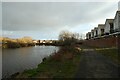
River path beside the Aire
Looking downstream along the River Aire below the confluence with the River Calder.
Image: © DS Pugh
Taken: 25 Feb 2023
0.03 miles
2

Total Filling Station - Savile Road
Image: © Betty Longbottom
Taken: 16 Aug 2010
0.05 miles
3

Boom on River Aire
Protecting craft from the weir down river
Image: © Kevin Waterhouse
Taken: 24 Jul 2025
0.05 miles
4

Boom across River Aire at Castleford
Situated just below the confluence of the Rivers Aire and Calder at Castleford the boom ensures rivercraft don't fall over the weir just downstream.
Image: © derek dye
Taken: 30 Jan 2012
0.06 miles
5
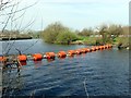
Boom on the River Aire
The boom prevents river craft from heading downstream towards a weir.
Image: © Graham Hogg
Taken: 11 Apr 2016
0.06 miles
6

Riverside Medical Centre - Savile Road
Image: © Betty Longbottom
Taken: 16 Aug 2010
0.06 miles
7
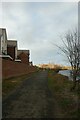
New housing and river path
Looking along the path in Castleford beside the River Aire.
Image: © DS Pugh
Taken: 25 Feb 2023
0.07 miles
8

Cormorant looking for a meal
A cormorant uses a partially submerged branch as a feeding perch.
Image: © derek dye
Taken: 11 Jan 2018
0.07 miles

10
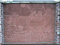
Iron Age Chariot
Tile Mosaic (H.Malkin) located off Saville Road nr junction of Church Street. Subject is an Iron Age Chariot remains of which had recently been uncovered nr Fryston Woods/ Ferrybridge Power Station during the construction of the new A1/M1 motorway.
Image: © bernard bradley
Taken: 30 Mar 2007
0.08 miles