IMAGES TAKEN NEAR TO
Long Elms, ABBOTS LANGLEY, WD5 0JR
Introduction
This page details the photographs taken nearby to Long Elms, WD5 0JR by members of the Geograph project.
The Geograph project started in 2005 with the aim of publishing, organising and preserving representative images for every square kilometre of Great Britain, Ireland and the Isle of Man.

There are currently over 7.5m images from over14,400 individuals and you can help contribute to the project by visiting https://www.geograph.org.uk
Image Map (Loading...)


Getting Data...Please wait
Leaflet Map data © OpenStreetMap
Images are licensed for reuse under creativecommons.org/licenses/by-sa/2.0
Notes
- Clicking on the map will re-center to the selected point.
- The higher the marker number, the further away the image location is from the centre of the postcode.
Image Listing (21 Images Found)
Images are licensed for reuse under creativecommons.org/licenses/by-sa/2.0
Image
Details
Distance
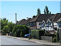
1
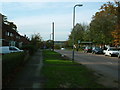
Hazelwood Lane, Abbots Langley
Looking east.
Image: © Ray Stanton
Taken: 12 Nov 2005
0.14 miles
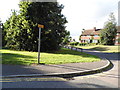
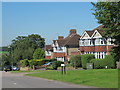
2
Green on Upper Highway, Abbots Langley
Image: © David Howard
Taken: 19 Sep 2012
0.14 miles
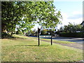
3
Upper Highway at the junction of Long Elms
Image: © David Howard
Taken: 19 Sep 2012
0.14 miles
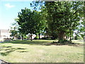
8
School Mead, WD5 (2)
Shows the location of Image
Image: © Mike Quinn
Taken: 24 Jul 2012
0.18 miles
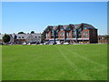
9
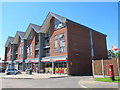
Shops and flats, School Mead, WD5
Shows the location of Image
Image: © Mike Quinn
Taken: 24 Jul 2012
0.18 miles
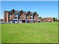
10
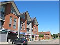
Shops and flats, School Mead, WD5 (2)
Shows the location of Image
Image: © Mike Quinn
Taken: 24 Jul 2012
0.18 miles