IMAGES TAKEN NEAR TO
Broomfield Rise, ABBOTS LANGLEY, WD5 0HY
Introduction
This page details the photographs taken nearby to Broomfield Rise, WD5 0HY by members of the Geograph project.
The Geograph project started in 2005 with the aim of publishing, organising and preserving representative images for every square kilometre of Great Britain, Ireland and the Isle of Man.

There are currently over 7.5m images from over14,400 individuals and you can help contribute to the project by visiting https://www.geograph.org.uk
Image Map (29 Images)


Getting Data...Please wait
Leaflet Map data © OpenStreetMap
Images are licensed for reuse under creativecommons.org/licenses/by-sa/2.0
Notes
- Clicking on the map will re-center to the selected point.
- The higher the marker number, the further away the image location is from the centre of the postcode.
Image Listing (29 Images Found)
Images are licensed for reuse under creativecommons.org/licenses/by-sa/2.0
Image
Details
Distance
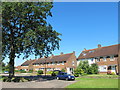
1
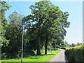
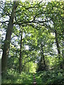
Greenways, Abbots Langley
A dead-end.
Image: © Robin Webster
Taken: 14 May 2017
0.04 miles
2
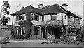
86 Gallows Hill Lane, Abbots Langley
One of six or seven large houses set on large plots built by Mr East (who lived in one of them) during the 1930s. This was one of two with addresses on Gallows Hill Lane, the rest standing along the east side of the northern end of Hazelwood Lane between its junction with Gallows Hill Lane and the (then) unadopted gravel road called Greenways which still runs along the edge of Tanners Wood but no longer gives vehicular access to Hazelwood Lane.
This was the house on the corner and my family lived there between 1954 and 1965. My bedroom was the one with the round window.
All but one of the houses (including this one) were demolished in the 1970s and the area redeveloped as an extension of Greenways with 27 houses on the same footprint. Some of the trees in the garden I remember climbing as a child were still there when I last went by.
The photograph was taken by my mother's aunt.
Image: © R E Joan Batterham
Taken: Unknown
0.06 miles
4
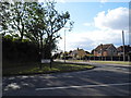
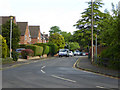
Hazelwood Lane at the junction of Gallows Hill Lane
Image: © David Howard
Taken: 19 Sep 2012
0.06 miles
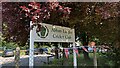
5
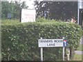
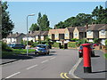
Road sign in Abbots Langley
In the wood immediately adjacent is a set of swings which are grown over with brambles. Curious that.
Image: © Jack Hill
Taken: 18 Aug 2005
0.11 miles
7
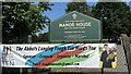
Manor Sports & Social Centre sign, Gallows Hill Lane
Image: © Bryn Holmes
Taken: 9 Jun 2023
0.13 miles
9
Abbots Langley Cricket Club sign, Gallows Hill Lane
Image: © Bryn Holmes
Taken: 9 Jun 2023
0.13 miles