IMAGES TAKEN NEAR TO
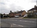
Summerhouse Way, ABBOTS LANGLEY, WD5 0EA
Introduction
This page details the photographs taken nearby to Summerhouse Way, WD5 0EA by members of the Geograph project.
The Geograph project started in 2005 with the aim of publishing, organising and preserving representative images for every square kilometre of Great Britain, Ireland and the Isle of Man.

There are currently over 7.5m images from over14,400 individuals and you can help contribute to the project by visiting https://www.geograph.org.uk
Image Map
Images are licensed for reuse under creativecommons.org/licenses/by-sa/2.0
Notes
- Clicking on the map will re-center to the selected point.
- The higher the marker number, the further away the image location is from the centre of the postcode.
Image Listing (60 Images Found)
Images are licensed for reuse under creativecommons.org/licenses/by-sa/2.0
Image
Details
Distance
1
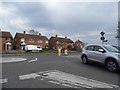
Tibbs Hill Road at the junction of High Street, Abbots Langley
Image: © David Howard
Taken: 16 Apr 2015
0.12 miles
2
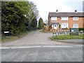
Tibbs Hill Road at the junction of Love Lane
Image: © David Howard
Taken: 16 Apr 2015
0.14 miles
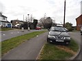
6
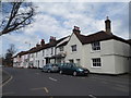
Terrace on High Street, Abbots Langley
Image: © David Howard
Taken: 16 Apr 2015
0.17 miles
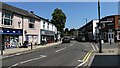
7
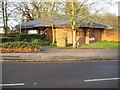
Abbots Langley Library & Hertfordshire pudding stone
The Library is located on the High Street.
The rock mounted on the brick plinth in front of the Library is an example of Hertfordshire pudding stone, a conglomerate of existing smaller flints and pebbles held together by a natural silica and sand cement, glacial in origin, scarce, and unique to the county. From the outside it resembles concrete but inside it looks akin to a fruit or Christmas pudding, from which it takes its name. It was procured for the parishioners of Abbots Langley by Frank Cooper, the local village gardener, who rescued it in 1986 when the land nearby was being excavated to build the Abbots Langley section of the M25 Motorway.
Image: © Nigel Cox
Taken: 1 Feb 2008
0.18 miles
8
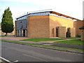
Abbots Langley: Roman Catholic Church of St Saviour
Located in The Crescent the Church was consecrated in 1963 and is in the Diocese of Westminster. Its website is here http://www.rcdow.org.uk/abbotslangley/default.asp
Image: © Nigel Cox
Taken: 1 Feb 2008
0.18 miles
9
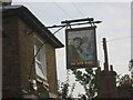
The Boys Home Pub Abbots Langley
A strange name for a pub but probably the original one.
Image: © Jack Hill
Taken: 18 Aug 2005
0.19 miles
10
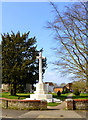
Abbots Langley War Memorial and churchyard
Image: © Diane Sambrook
Taken: 4 Mar 2015
0.19 miles