1
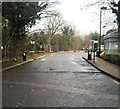
Barrier across road
Image: © Alex McGregor
Taken: 7 Jan 2015
0.06 miles
2
Office block on Tolpits Lane, Holywell
Entering Watford from the west
Image: © David Howard
Taken: 11 Dec 2014
0.11 miles
3
Course of old railway, Wolsey Business Park
Dwight Road and a cycle trail, the Ebury Way, occupy the course of the old LNWR branch to Rickmansworth. The trail uses much of the length of this branch, which closed in 1960 over this section, passenger services finishing in 1952.
Image: © Robin Webster
Taken: 1 Feb 2015
0.13 miles
4
Tolpits Lane at the junction with Dwight Road
The start of the large industrial estate
Image: © David Howard
Taken: 11 Dec 2014
0.13 miles
5
Watford: Camelot Head Office, Tolpits Lane
Camelot http://www.camelotgroup.co.uk/index.html is the licensed operator of the UK National Lottery. The National Lottery has recently revealed that the price of living the millionaire lifestyle and being "comfortably rich" in the UK has risen to £5.8 million...
Image: © Nigel Cox
Taken: 21 Mar 2008
0.14 miles
6
Watford: Ebury Way, Tolpits Lane bridge
Ebury Way viewed looking west towards the A4145 Tolpits Lane bridge and then to Rickmansworth. Ebury Way follows the trackbed of the long dismantled railway line from Watford to Rickmansworth. Opened in 1862, it was shortly afterwards taken over by the London & North Western Railway, but was an early victim of the post-war Nationalization of the railways, closing to passenger traffic in 1952.
Image: © Nigel Cox
Taken: 26 Nov 2020
0.15 miles
7
Decorative electricity sub station
Image: © Alex McGregor
Taken: 7 Jan 2015
0.15 miles
8
Office Buildings at Business Park Tolpits Lane Rickmansworth
The anonymous office buildings are slightly forbidding
Image: © Jack Hill
Taken: 12 Jul 2005
0.15 miles
9
Watford: Ebury Way
Ebury Way viewed looking west towards the A4145 Tolpits Lane bridge and then to Rickmansworth. Ebury Way follows the trackbed of the long dismantled railway line from Watford to Rickmansworth. Opened in 1862, it was shortly afterwards taken over by the London & North Western Railway, but was an early victim of the post-war Nationalization of the railways, closing to passenger traffic in 1952. It is now a popular route for cyclists. The blue sign has a wildly overoptimistic distance of ¼ mile to Cassiobury Park and Watford Met Line Station. The very nearest point in the park is at least 1 mile away and the station at least a ¼ mile beyond that!
Image: © Nigel Cox
Taken: 21 Mar 2008
0.16 miles
10
Watford: A4145 Tolpits Lane pedestrian crossing
A view taken looking from the Ebury Way towards Holywell across Tolpits Lane.
Image: © Nigel Cox
Taken: 21 Mar 2008
0.20 miles


