IMAGES TAKEN NEAR TO
Elton Way, WATFORD, WD25 8HH
Introduction
This page details the photographs taken nearby to Elton Way, WD25 8HH by members of the Geograph project.
The Geograph project started in 2005 with the aim of publishing, organising and preserving representative images for every square kilometre of Great Britain, Ireland and the Isle of Man.

There are currently over 7.5m images from over14,400 individuals and you can help contribute to the project by visiting https://www.geograph.org.uk
Image Map
Images are licensed for reuse under creativecommons.org/licenses/by-sa/2.0
Notes
- Clicking on the map will re-center to the selected point.
- The higher the marker number, the further away the image location is from the centre of the postcode.
Image Listing (14 Images Found)
Images are licensed for reuse under creativecommons.org/licenses/by-sa/2.0
Image
Details
Distance
1
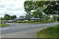
Imperial China restaurant, Watford
On the A41.
Image: © Robin Webster
Taken: 10 Jun 2015
0.02 miles
2
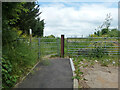
Footpath towards Patchetts Green
Here leaving the A41.
Image: © Robin Webster
Taken: 10 Jun 2015
0.07 miles
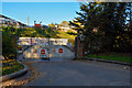
3
Watford : Roadside
The roadside off of North Western Avenue.
Image: © Lewis Clarke
Taken: 3 Oct 2018
0.07 miles
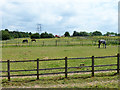
6
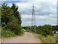
Track and pylon
The track is used by a public footpath from the A41 to Patchetts Green. A bridge over the M1 can just be glimpsed round the corner.
Image: © Robin Webster
Taken: 10 Jun 2015
0.16 miles
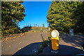
7
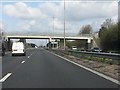
M1 motorway - Patchetts accommodation bridge
Image: © Peter Whatley
Taken: 3 Apr 2012
0.19 miles
8
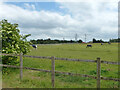
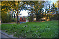
Watford : The Conifers
Looking towards a yard off of North Western Avenue.
Image: © Lewis Clarke
Taken: 3 Oct 2018
0.21 miles
9
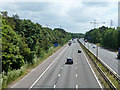
M1 looking southbound
Between junctions 5 and 4.
Image: © Robin Webster
Taken: 10 Jun 2015
0.21 miles
10
Watford : Roadside
The side of the road off North Western Avenue.
Image: © Lewis Clarke
Taken: 3 Oct 2018
0.22 miles