IMAGES TAKEN NEAR TO
Cedar Wood Drive, WATFORD, WD25 0RR
Introduction
This page details the photographs taken nearby to Cedar Wood Drive, WD25 0RR by members of the Geograph project.
The Geograph project started in 2005 with the aim of publishing, organising and preserving representative images for every square kilometre of Great Britain, Ireland and the Isle of Man.

There are currently over 7.5m images from over14,400 individuals and you can help contribute to the project by visiting https://www.geograph.org.uk
Image Map
Images are licensed for reuse under creativecommons.org/licenses/by-sa/2.0
Notes
- Clicking on the map will re-center to the selected point.
- The higher the marker number, the further away the image location is from the centre of the postcode.
Image Listing (14 Images Found)
Images are licensed for reuse under creativecommons.org/licenses/by-sa/2.0
Image
Details
Distance
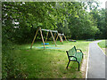
2
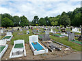
Play area by North Watford Cemetery
The cemetery is off to the left.
Image: © Robin Webster
Taken: 10 Jun 2015
0.16 miles
3
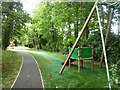
Play area by North Watford Cemetery
The cemetery is off to the right.
Image: © Robin Webster
Taken: 10 Jun 2015
0.17 miles
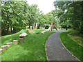
4
Footpath from Fern Way to St Albans Road
Also to a small play area and a way in to North Watford Cemetery.
Image: © Robin Webster
Taken: 10 Jun 2015
0.17 miles
6
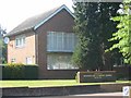
Headquarters of Seventh Day Adventist Church, Garston
The area is mainly housing with some shops so the HQ stood out
Image: © Jack Hill
Taken: 10 Jul 2005
0.19 miles
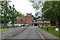
8
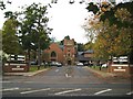
Garston: Seventh-day Adventist Church: Stanborough Centre
The Church was founded in Stanborough Park in 1927 as the "church in the woods". Today its address is 609 St Albans Road.
Seventh-day Adventists are a Christian faith community preparing the world for the return of Jesus Christ. Their website is here http://www.adventist.org.uk/
Image: © Nigel Cox
Taken: 10 Oct 2009
0.21 miles
9
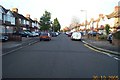
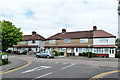
Watford: Kingswood Estate
A view looking westwards down Kingswood Road from its junction with Moss Road, this estate of 1920s - 1940s housing covers the southern third of this grid square.
Image: © Nigel Cox
Taken: 30 Oct 2005
0.21 miles
10
Seventh Day Adventist church, Watford
A large modern more building is off to the right, part of the centre here in Stanborough Park.
Image: © Robin Webster
Taken: 10 Jun 2015
0.21 miles